mail_outline sales@mediastorehouse.com
128 items
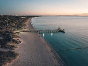
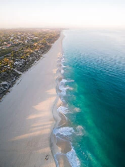
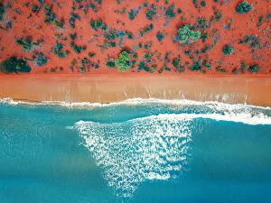
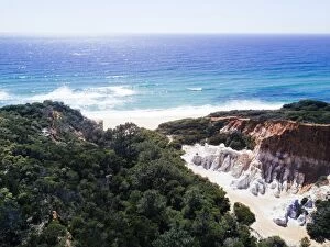
Coogee Beach at DuskAerial drone images above Coogee beach in Western Australia
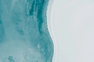
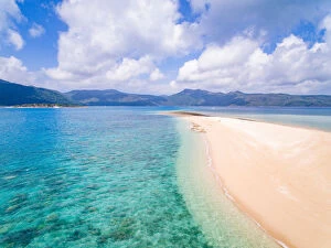
Aerial View of Little Lagoon Shark Bay - DRONE 4K
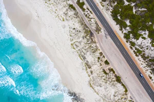
Beachlife Drone Photography CollectionThis spectacular drone photography collection was taken by a DJI Phantom 4 Pro. These pictures really bring out the beauty of Australia and would look good anywhere
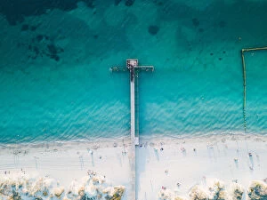
coogee beach jettyAerial drone images above Coogee beach in Western Australia
Aerial View of 11 Mile Beach Esperance Western Australia - 4K DRONE
Perth City BeachSunrise at City Beach in Perth Western Australia
Aerial View of Great Ocean Road in Victoria, Australia
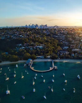
Sydney City from afarDrone Aerial Views
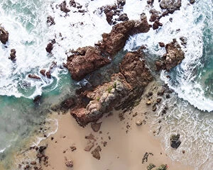
Droning in Port MacquarieTop down view of the beach rocks and ocean
Paddle paradisePeaceful morning at Chinamans Beach, Jervis Bay
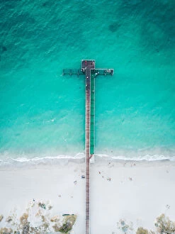
coogee jetty drone photoAerial drone images above Coogee beach in Western Australia
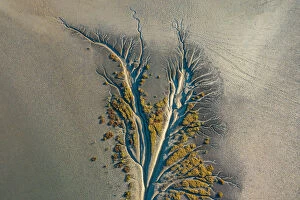
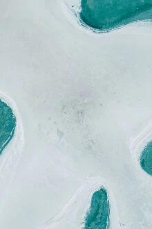
Mangrove AerialMangrove tributaries wind their way through salt flats
Simplistic aerial shot above Lake Dumbleyung, AustraliaDrone Aerial Views
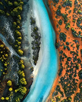
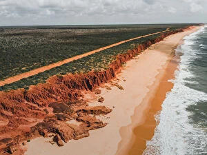
Aerial top view of a bright orange sandy beachNatural bright orange sandy beach from above
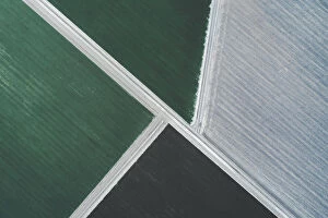
Aerial view of Patterns in the dry cracked soil of drought conditions over farming lands, Moogerah dam, Australia
Abstract aerial image of Lake Dumbleyung, AustraliaDrone Aerial Views
Agricultural activity shot from directly above, New South Wales, AustraliaDrone Aerial Views
Aerial view of the Ivanhoe crossing, Western AustraliaDrone Aerial Views
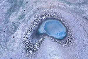
Drone shot above a salt lake, South AustraliaDrone Aerial Views
Aerial view of patterns, textures and amazing colors, pinkAerial view of patterns, textures and colors, pink, purple and orange over a Pink Lake in Lochiel, South Australia
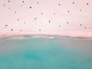
Aerial View of People Social Distancing at the Beach
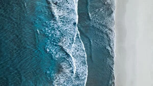
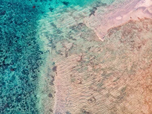
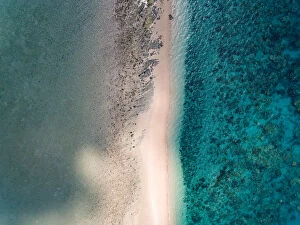
Drone shot showing waves rolling onto a beach, Esperance, AustraliaDrone Aerial Views
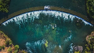
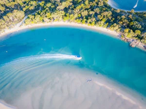
Aerial View of Noosa River with boat passing throughAerial view from a drone of Noosa river with a boat passing through, Australia
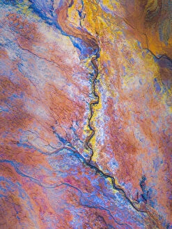
Surreal mine tailings shot from directly above, South AustraliaDrone Aerial Views
James Price Point coastline as seen from a drone point of view, Western AustraliaDrone Aerial Views
twilight cove drone shotAn aerial view over twilight beach in Esperance, Western Australia
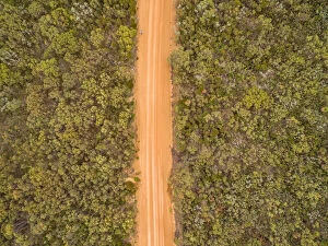
Drones: An Aerial Road TripAerial image of real country road in western australia
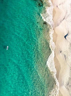
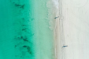
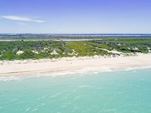
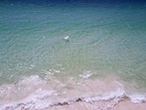
Summer Sandy Beach AerialBlue waters and white sandy beach from drone perspective
Texture of the Ocean beachdrone photo of the texture of the sea beach, photo taken in Dingo beach, Queensland, Australia, photo taken by drone device Dingo Beach is a small township on the northern side of the Whitsunday
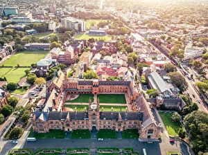
Sydney University AerialThe University of Sydney was established as Australias first tertiary institution in 1850
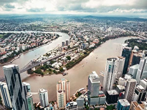
Brisbane City Aerialdrone photo of the Brisbane city downtown area, photo taken by drone device 2018/02
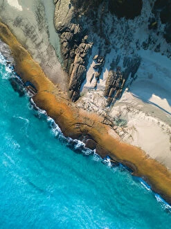
The Hidden BeachI found this tiny beach whyall flying my drone over a large rock face in Albany Western Australia, what a location
Drone photo of the Arlie beach portAirlie Beach is one of many departure points for the Great Barrier Reef. Near latitude 20 degrees south, Airlie Beach, Proserpine and the nearby Whitsunday Islands enjoy a tropical climate
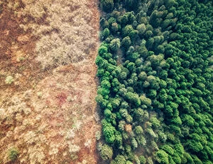
Green and YellowDrone photo of a forest with yellow color grass and green color forest. photo taken in Chengdu city, Sichuan Province, China 2018/01
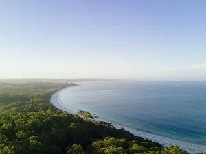
Aerial view of 90 mile Beach and landscape, Victoria, AustraliaThe Ninety Mile Beach is a sandy stretch of beach on the south-eastern coastline of the East Gippsland region of Victoria in Australia. The beach faces Bass Strait and backs the Gippsland Lakes
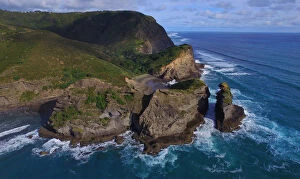
Rock Formation in Piha Beach, North Island, New Zealandphotography, Drone Aerial Views, 519695524
Top View Of Big Wave In Sea, Taranaki, New ZealandDrone Aerial Views, 677352594
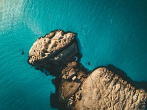
Langford IslandOverhead drone photo of Langford island
Aerial view of the Pinnacles rock formations and sea, New South Wales, AustraliaDrone Aerial Views, 643251056
Aerial view of an empty beach, Hyams Beach, Jervis Bay, AustraliaDrone Aerial Views, 643250818
Sunset aerial view of sea and landscape, Jervis Bay, AustraliaDrone Aerial Views, 643007298
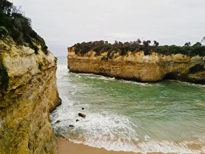
Aerial view of Limestone formations east of Loch Ard Gorge, 12 Apostles, Great Ocean Road, VictoriaDrone Aerial Views, 643784790
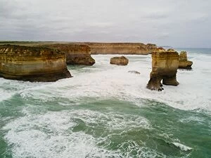
Aerial view of Loch Ard Gorge, 12 Apostles, Great Ocean Road, VictoriaDrone Aerial Views, 643784788
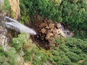
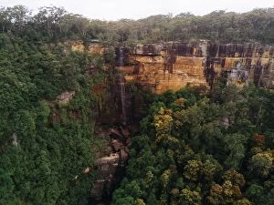
Aerial view of Fitzroy Falls, New South Wales, AustraliaDrone Aerial Views, 643250644
Aerial view of Fitzroy Falls, New South Wales, AustraliaDrone Aerial Views, 643250638
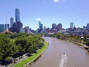
Aerial view of the Melbourne skyline and Yarra River, in a blue day, VictoriaDCIM100MEDIADJI_0030.JPG
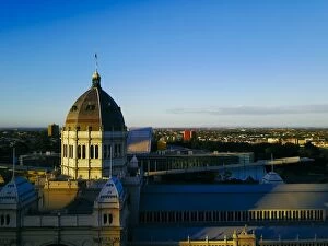
Sunset Aerial view of north Melbourne and the exhibition centre, Carlton gardens, VictoriaThe The Royal Exhibition Building in the Carlton Gardens is a World Heritage Site located on the north eastern edge of the Central Business District in the suburb of Carlton, in Melbourne, Victoria