mail_outline sales@mediastorehouse.com
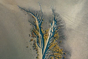
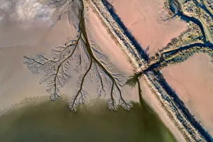
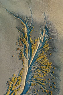
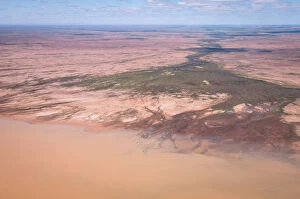
Mangrove AerialMangrove tributaries wind their way through salt flats
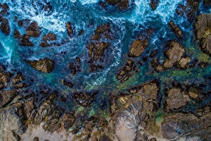
Above the rocksIts high above the coastline where you can see exactly how clean and clear the water is. It looks so refreshing this high up in Monterey
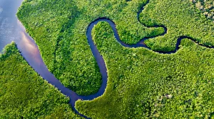
Daintree River BendsThe Daintree Rainforest, Australia
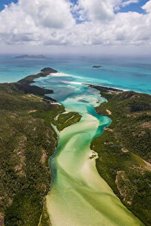
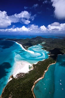
Great Barrier Reef and Hardy Reef, AustraliaAerial images from a private charter helicopter over the Great Barrier Reef and Hardy Reef, Australia
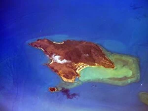
Salt Flat AerialAerial views from directly above of patterns and subjects in a salt flat
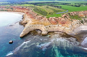
Aerial View of the Rocky Coastline of Cape JarvisAerial View of the Rocky Coastline, colored rocks and blue ocean waters of Cape Jarvis in South Australia
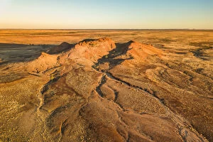
Outback AerialLandscapes from above in Outback Queensland
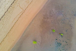
Beach and Mangrove Tree AerialAerial patterns on a beach with mangrove trees
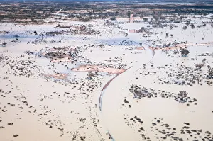
Aerial view of flooded Birdsville Track, AustraliaAerial view over the flooded iconic Birdsville Track at ephemeral Lake Killamperpunna on Cooper Creek in outback South Australia
aerial, area, bay, bondi, bronte, coast, manly, nova, ocean, pacific, scenic, scotia, vacation, view, waves, Bronte Beach, 518329784
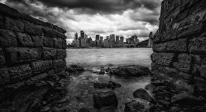
View of Sydney city and Anzac BridgeSydney, Australia
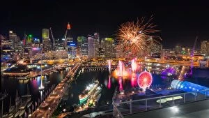
Sydney City and Darling Harbour FireworkDarling Harbour, Sydney, Australia
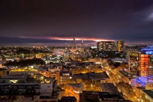
Melbourne sunset at St. KildaMelbourne, Victoria, Australia
View of downtown SydneySydney Harbour night time Panorama viewed from North Sydney
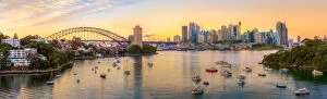
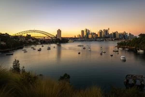
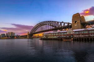
Sydney Sunrise take from Gladesville BridgeAerial photo of Sydney Central Business District with skyline and Harbour bridge. Sydney iconic Harbour Bridge and Central Business District office buildings.r
Panoramic view of Sydney Central Business District, AustraliaSydney Harbour Panorama - View from Waverton containing the tourist lookout towards the Central Business District and the Opera House
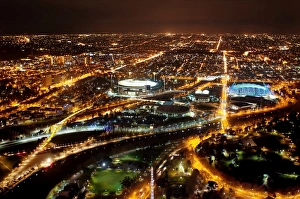
The Night Lights of Melbourne City, Victoria, AustraliaMelbourne is the capital and most populous city in the Australian state of Victoria, and the second most populous city in Australia and Oceania
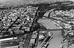
Aerial Of Melbourne, Australia, 1954Aerial view of Melbourne, the capital of Victoria, Australia, December 1954. Along the banks of the Yarra River to the left is the Flinders Street Railway Station
Aerial view of Strezlecki Desert flood, AustraliaAerial view of floodwaters making their way into a small basin in the gibber plains of the Strezlecki Desert in outback South Australia. Creeks flow only very rarely in this arid landscape
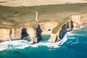
Aerial view of twelve apostles coast, AustraliaAerial view of twelve apostles coast near Loch Ard gorge. Great Ocean road, Port Campbell national park, Victoria, Australia
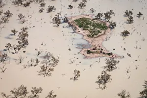
Aerial view of island in Lake KillamperpunnaAerial view of small island in the ephemeral Lake Killamperpunna in outback South Australia. This lake fills from Cooper Creek only when good rainfall in the upper catchment is able to travel all
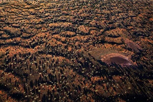
Shadows Of desert oak trees over outbackAn aerial photo taken from helicopter of long shadows of Desert Oak trees and water hole at sunset in outback near Lake Amadeus Northern Territory Australia
Shy albatross, (Thalassarche cauta), adult flying, Cape of the Good Hope, South Africa
Small puff of cloud hovers over Hayman IslandThis rocky, grass-covered island lies in the Pacific Ocean off the coast of North Queensland, Australia. Part of the Whitsunday group of islands
Dramatic of SydneyMoody day of Sydney from Kirribilli park in North Sydney
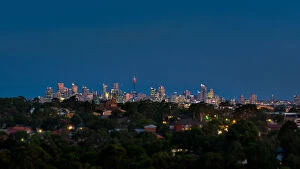
Sydney Build view after sunsetSydney city view from Ryde (suburb in Sydney)
Aerial view of downtown Sydney after sunsetThe building of Sydney Central Business District, Sydney, NSW, Australia
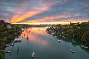
Waverton sunrise, Sydney, AustraliaSunrise at Waverton and Sydney city background
Sydney City Sunrise at Waverton, AustraliaWaverton is not to far form city. You can catch a train to Waverton station
Sydney skyline at dawnSydney Harbour Bridge in a winter at Sydney, Australia
Barangaroo construction site aerial viewSouth Barangaroo redevelopment project includes construction of three commercial skyscrapers with large recreational area
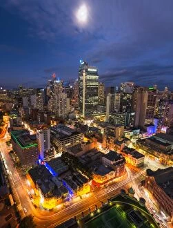
View on night highlighted Sydney Central Business DistrictSydney Australia aerial view sunset with Blue sky and clouds at city with illuminated skyscrapers
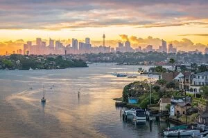
Sydney Central Business District sunriseTake from Waverton
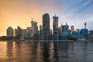
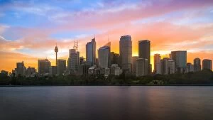
Panoramic view of SydneyAerial view of downtown Sydney at sunset, Australia
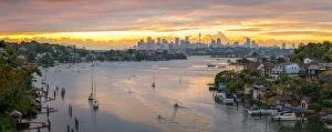
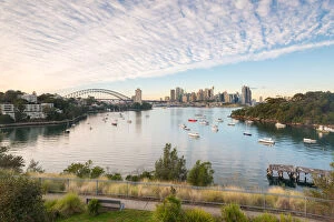
Aerial view of Sydney, AustraliaParramatta River, Gladesville Bridge
Paramatta River, Sydney, Australiasydney city Central Business District aerial view from Gladesville Bridge surrounding residential from western suburbs
The Dassie Rat (Rock Hyrax) @ the Top of Table Mountain, Cape Town, Western Cape, South Africa
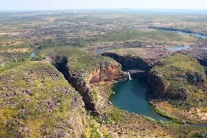
Landscape of Mitchell FallsThe view taken from a helicopter on arrival at the Mitchell Falls in Western Australias far north
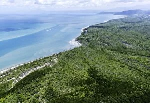
Daintree CoastlineAerial image of the coastline of the world heritage daintree national park
Industrial Tailing Pondsaerial image of industrial tailing ponds
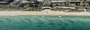
Scarborough Beach AerialA 20 minute drive north west of Perth Scarborough Beach is a firm favourite for teens and surfers, . The regular swell, impressive surf breaks and long stretch of white sand attract swimmers
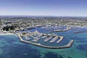
Fishing Boat Harbour AerialAerial image of fishing boat harbour fremantle western australia