mail_outline sales@mediastorehouse.com
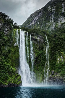
Milford Sound waterfall, New ZealandWaterfall in New Zealands Milford Sound, Fiordland National Park
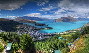
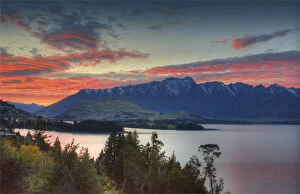
Stunning Queenstown Scene, New Zealand South IslandQueenstown, New Zealand is located on the shores of New Zealands South Islands Lake Wakatipu, set against the dramatic Southern Alps
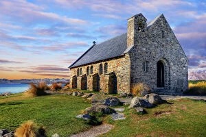
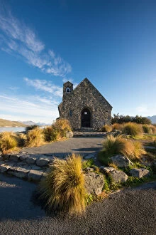
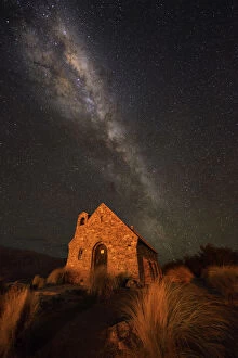
Church of the Good ShepherdSituated on the shores of Lake Takapo, the Church of the Good Shepherd was built to the glory of God and as a memorial to the pioneers of the Mackenzie Country
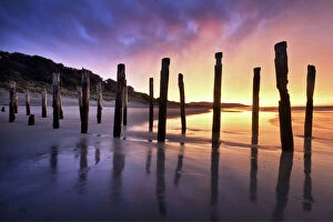
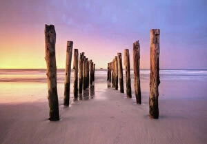
The Old Jetty Remains, St Clair Beach, DunedinThe Old Jetty Remains at St Clair Beach in Dunedin, South Island, New Zealand
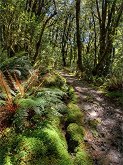
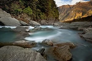
The Milford Track Rain ForestNew Zealands most famous 53 kilometre walk, the Milford track is in the southwest of South Island amidst mountains and temperate rain forests
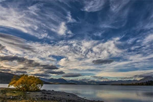
Lake Tekapo, Canterbury plains, south island, New ZealandLake Tekapo is the second-largest of three roughly parallel lakes running northa'south along the northern edge of the Mackenzie Basin in the South Island of New Zealand
Queenstown, South Island, New Zealand
St Clair Beach, Dunedin, South Island, New ZealandOld jetty remains at St Clair beach in Dunedin, South Island of New Zealand
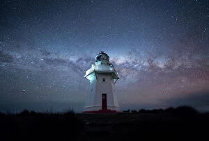
Lighthouse and the nights milkyway
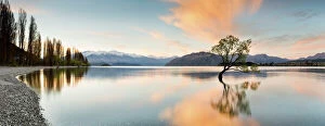
Wanaka - Lone tree sunrise at lake wanakaWanaka New zealand south island
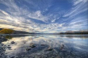
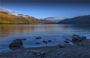
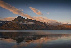
Dawn on lake Wakatipu, New Zealand south islandOlympus Digital Camera
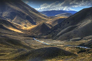
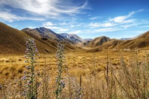
Lindis Pass, on the mountainous road through to Cromwell, south island, New ZealandLindis Pass is located in the South Island of New Zealand. It lies between the towns of Cromwell in Central Otago and Omarama in North Otago
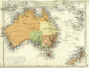
Antique map of Australia and New ZealandVintage map of Australia and New Zealand in 1861
Under the million stars at Church of the Good ShepherdMilky way at Church of the Good Shepherd, Lake Tekapo New Zealand
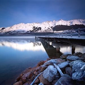
Lake Wakatipu in New ZealandGlenorchy is small settlement nestled in spectacular scenery at northern end of Lake Wakatipu in New Zealands south Island
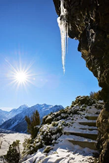
Mountain hike, trekking with icicle in snowtrekking in mount cook national park on a cold winters morning with the warm mornings sun, snow covering the ground and icicles hanging from the rock outcrops
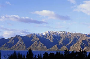
New Zealand, South Island, Lake Hawea and The Remarkables, winterThe Remarkables mountain range
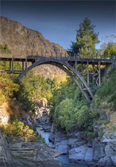
Shotover river and bridge near Queenstown, South Island, New ZealandS
A view in the early moprning light of the Remarkables, a mountain range near Queenstown, South Island, New Zealand
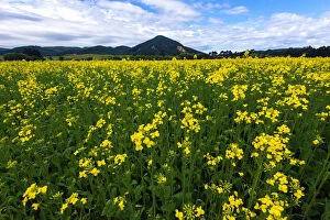
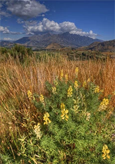
Beautiful New ZealandYellow flowers field
touching on the topSunset at mount cook, it is the last light of the day touches on the top of mount cook
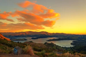
Sunset at Port hills observation point Christchurch
Church of the Good Shepherd on a sunny day
snowy mountain scenic view
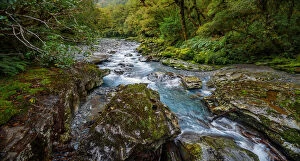
Glacial StreamMount Aspiring National Park is located in the Southern Alps of the South Island of New Zealand, north of Fiordland National Park, and between Otago and south Westland
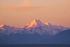
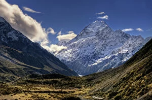
Mt CookAoraki / Mount Cook is the highest mountain in New Zealand, reaching 3, 724 metres. It lies in the Southern Alps, the mountain range which runs the length of the South Island
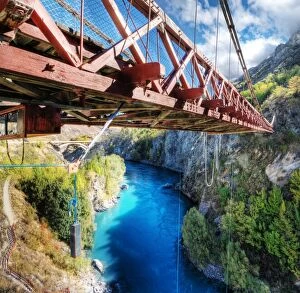
Kawarau River & Suspension Bridge, Queenstown, NZKawarau Suspension Bridge overlooking Kawarau River at Queenstown, South Island, New Zealand
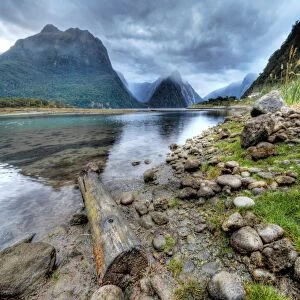
Milford Sound, Fiordland National Park, NZMilford Sound in Fiordland National Park, South Island, New Zealand
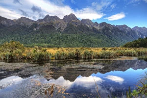
The Mirror Lake, Eglinton Valley, FiordlandThe Mirror Lake at Eglinton Valley in Fiordland National Park, South Island, New Zealand
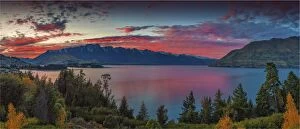
Sunset View of Lake Wakatipu With Surrounding Mountains, Queenstown-Lakes District, Otago Region, South IslandLake Wakatipu is an inland lake (finger lake) in the South Island of New Zealand. It is in the southwest corner of the Otago Region, near its boundary with Southland
The Chasm in Fiordland National Park and Milford Sound Area in the Fiordland Region, Te Anau, South Island, New ZealandThis popular walk is on the Milford side of the Homer Tunnel and is well signposted. Two footbridges over the Cleddau River offer spectacular views of a series of waterfalls
View of the Crown Range Summit in Otago, Wakatipu District, South Island, New ZealandThe Crown Range lies to the east of the Wakatipu Basin in Otago, New Zealand. It is noted for two features, the Cardrona Alpine Resort, on the slopes of the 1900 metre Mount Cardrona, and a highway
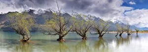
Glenorchy old trees as storm front approachesGlenorchy, south island New zealand
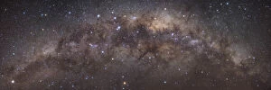
Milky way by nightNight sky taken over mount cook
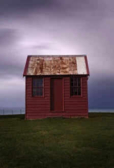
Red shed with stormy cloudsLittle red shed sits on hill top with storm clouds above
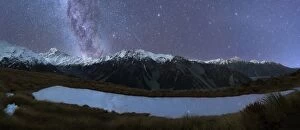
Milkyway and stars above the skies of mount cookTarn reflection of the milkyway and stars in mount cook national park
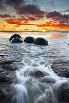
Moeraki boulders at sunrisemoeraki boulders are a group of very large spherical stones on Koekohe Beach near Moeraki on New Zealands Otago coast
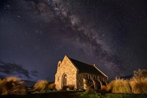
Lake Tekapo church under the Milky WayFamous church of the good Shepard, captured at night under the Milky Way
Autumn skies on Lake TekapoAutumn skies over Lake Tekapo, South Island New Zealand
Coronet Peak at DawnThe View from Coronet Peak near Queenstown on the South Island of New Zealand at Dawn
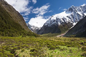
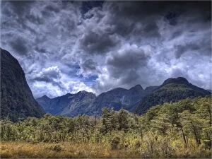
The Milford Track and Clinton River Valley in the South Island of New Zealand
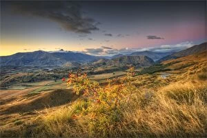
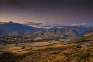
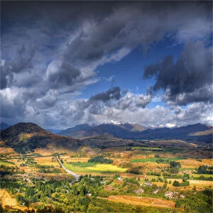
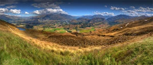
View to the Cardrona Valley, near Queenstown, South Island of New Zealand
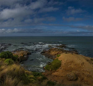
The coastline near Hillgrove on the South Island of New Zealand
A pnaoramic view from coronet peak, near Queenstown, South Island, New Zealand
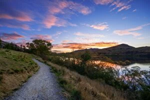
Lake Wakatipu, near Queenstown, South Island, New Zealand