mail_outline sales@mediastorehouse.com
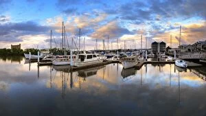
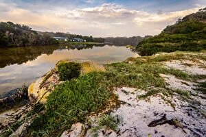
Launceston, TasmaniaA nice reflection in a beautiful evening at Launceston, Tasmania
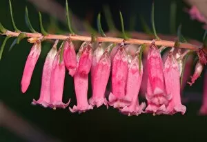
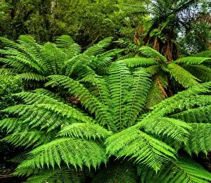
Coral HeathA coral heath found in understorey of temperate wet sclerophyll forest, Liffey River Australian Bush Heritage Fund Conservation Reserve, foothills of the Western Tiers, Tasmania, Australia
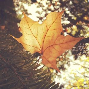
Soft autumn leafLight shining through autumn leaf
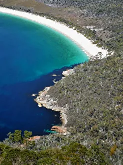
View to Hawksnest Cove and Wineglass Bay, Freycinet National Park, TasmaniaColes Bay, Tasmania, Australia - October 2, 2017: The arc of Wineglass Bay from the Wineglass Bay overlook trail
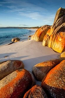
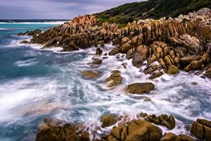
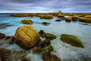
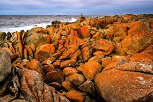
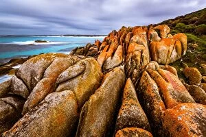
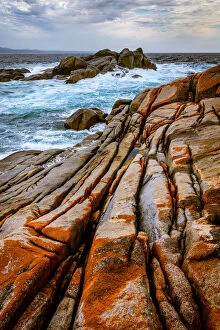
Bay of FiresPristine beach and red lichen covered rocks at Bay of Fires, Tasmania, Australia
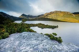
Australia, Cradle Mountain, Dove Lake, Getty Images, island, Tasmania, TasmanianTasmania Australia
Bay of Fires on northeastern coast of Tasmania in Australia
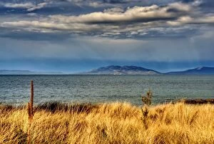
Stormy skyView from Swansea overlooking ocean out to Coles Bay
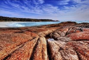
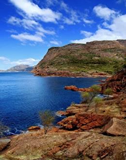
Bay viewView of bay with stunning red rock on Freycinet Peninsula in Tasmania
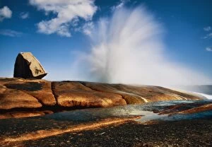
Blow holeBlow-hole in action at Bicheno in Tasmania Australia
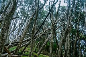
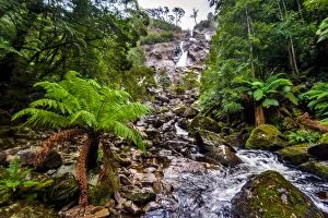
Mt Victoria Forest ReserveTasmanian rainforest at Mt Victoria Forest Reserve
Mount William National Park at Bay of Fires, Tasmania
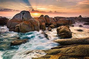
Deep Creek in Mount William National Park at Bay of Fires, Tasmania
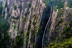
Columba Falls, TasmaniaColumba, Tasmanias highest waterfall
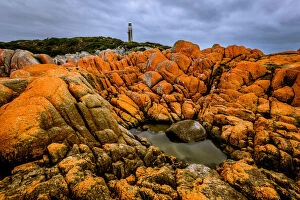
Eddystone Point Lighthouse at Mount William National Park in Bay of Fires, Tasmania
Deep Creek (Picnic Rocks) at Mount William National Park, Bay of Fires, Tasmania
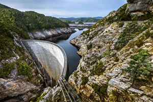
Gordon Dam in Southwest Tasmania198m long and 140m high Gordon Dam in Southwest Tasmania
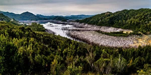
Lake Gordon in Southwest Tasmania
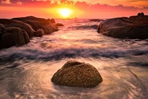
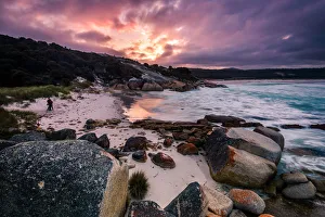
Binalong Bay at Mount William National Park, nBay of Fires, TasmaniaSunset at Binalong Bay at Mount William National Park, nBay of Fires, Tasmania
Binalong Bay at Bay of Fires, TasmaniaBinalong Bay at Mount William National Park, nBay of Fires, Tasmania
Ralphs Falls at Mt Victoria Forest Reserve, Tasmania
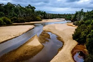
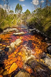
George River, Tasmania
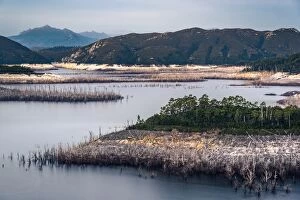
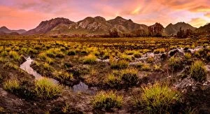
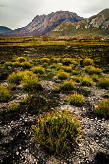
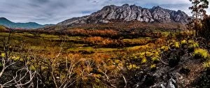
View to the Sentinel Range in Gordon River Valley after 2016 fires. Southwest Tasmania
Notley Fern Gorge, Tasmania
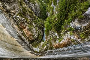
Gordon Dam in Southwest TasmaniaLooking down to 198m long and 140m high Gordon Dam in Southwest Tasmania
River (Pass Creek) at Arthur Plains in Southwest Tasmania
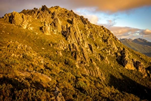
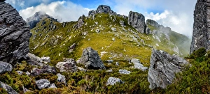
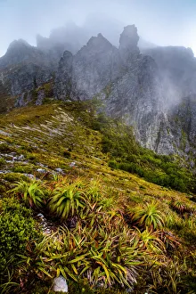
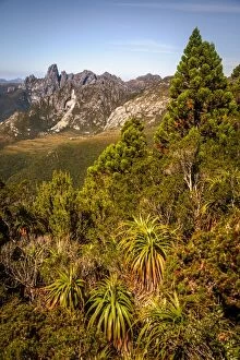
View to West Portal and Eastern Arthurs in Western Arthurs Range, Southwest Tasmania
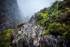
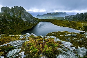
Steep track down to Lake Oberon Western Arthurs Range, Southwest Tasmania
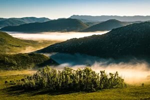
Morning fog at Southwest Tasmania. View from Eastern Arthur Range
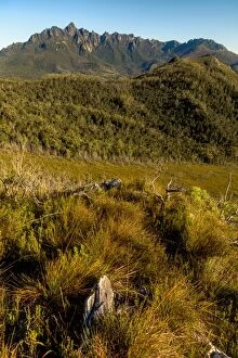
Eastern descent from mt. Hayes in Western Arthurs Range, Southwest Tasmania
View to Federation Peak in Eastern Arthur Range, Southwest Tasmania
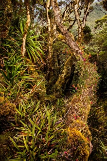
Rainforest at Goon Moor in Eastern Arthur Range, Southwest Tasmania
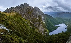
View of Hanging Lake and Eastern Arthurs Range from Geeves Bluff. Southwest Tasmania
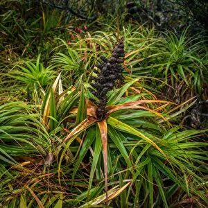
Richea Dracophylla in Southwest Tasmania
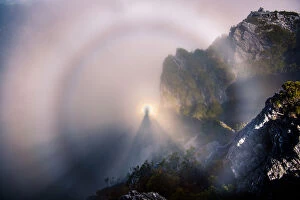
Brocken Spectre at the top of Dorado Peak in Western Arthurs Range
View of Eastern Arthurs Range from Hanging Lake, Southwest Tasmania
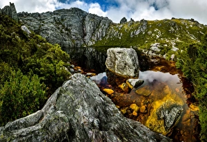
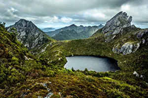
Square Lake in Western Arthurs Range, Southwest Tasmania
View to West Portal from Eastern Arthur Range, Southwest Tasmania
Lake GeevesView of Eastern Arthurs Range and Lake Geeves from Hanging Lake, Southwest Tasmania
Haven Lake in Western Arthurs Range, Southwest Tasmania