mail_outline sales@mediastorehouse.com
119 Photographic Prints
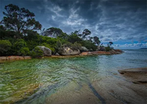
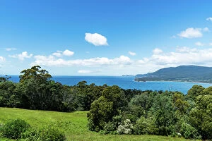
Fotheringate bay near the Strzelecki National Park, Flinders Island, Bass Strait, Tasmania
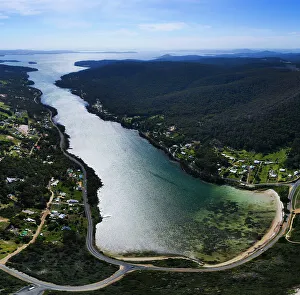
North east river estuary, Flinders Island, Bass Strait, Tasmania
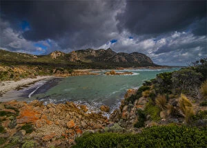
Coastal light Strzelecki National park, Flinders Island, Bass Strait, Tasmania
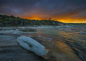
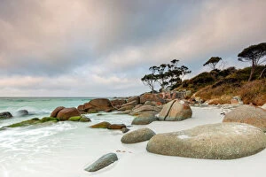
Dawn at Blue rocks on Flinders Island, Bass Strait, Tasmania
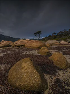
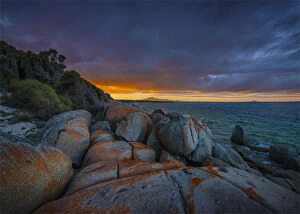
Dramatic light on the Docks on the west coastline of Flinders Island, Bass Strait, Tasmania
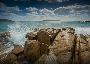
Killiecrankie bay, west coastline of Flinders Island, Bass Strait, Tasmania
Sunrise at Blue Rocks on Flinders Island, Bass Strait, Tasmania
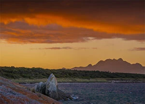
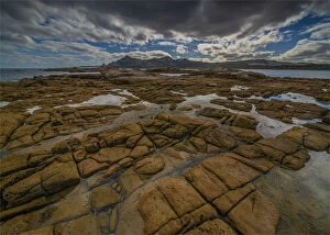
Marshall bay, western coastline of Flinders Island, Bass Strait, Tasmania
Trousers point, Flinders Island, Bass Strait, Tasmania
Marshall bay and views of Castle rock, western coastline of Flinders Island, Bass Strait, Tasmania
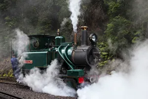
Steam Train, West Coast Wilderness Railway, Tasmania, AustraliaRestored steam engine, billowing steam, on the journey from Strahan to Queenstown, Tasmania, Australia
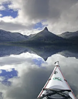
Tranquil paddle on Lake St Clair, Tasmania, AustA tranquil winter paddle on a calm Lake St Clair, Tasmanian Wilderness World Heritage Area, Tasmania
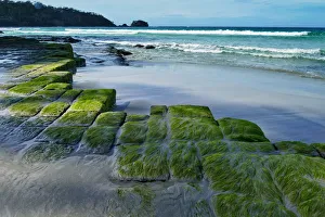
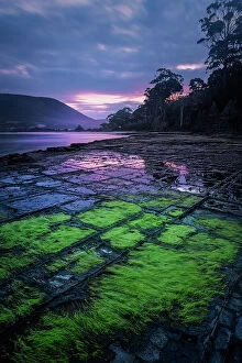
Moss covered rock formation at beach, Tessellated Pavement, TasmaniaEaglehawk Neck, Tasmania - September 3, 2017: Moss-covered blocks of the Tessellated Pavement rock formation with Pirates Bay in the background
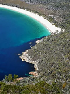
View to Hawksnest Cove and Wineglass Bay, Freycinet National Park, TasmaniaColes Bay, Tasmania, Australia - October 2, 2017: The arc of Wineglass Bay from the Wineglass Bay overlook trail
Howrah Beach, Hobart, TasmaniaHobart, Tasmania, Australia - September 24, 2017: People walking along Howrah Beach, on the eastern shore of the River Derwent, in the Hobart suburb of Howrah
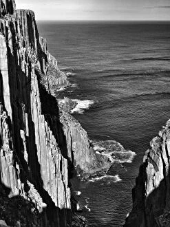
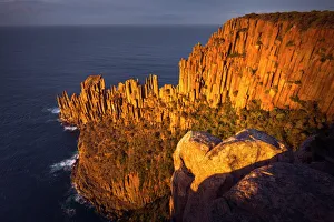
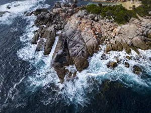
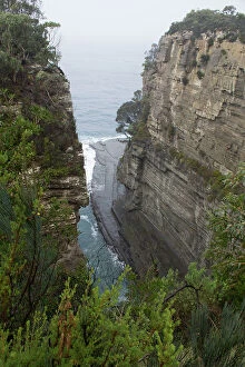
Sea cliffs, Cape Hauy, TasmaniaNear Port Arthur, Tasman National Park, Tasmania - September 2, 2017: Sea cliffs along the Cape Hauy track, the highest in Australia
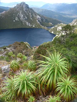
Pandani over Lake Oberon, Tasmania, AustraliaA classic view of Lake Oberon with Pandanus in the foreground. Western Arthur Range, Tasmania World Heritage Area, Southwest National Park, Tasmania, Australia
Tasmania (TAS)Australian Views Travel: Tasmania (TAS)
the flag of Tasmania
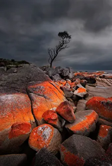
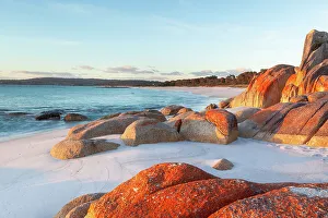
Bay of Fires in TasmaniaRed lichen covered rocks on beach, Bay of Fires. Tasmania, Australia
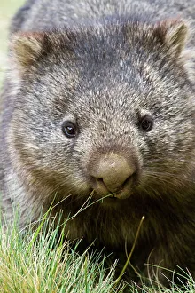
Australian wombatAustralian common wombat is marsupial and herbivore, only coming out at dusk and evening to feed
StargazingHobart capital of Tasmania. Australia
Deep Creek at William National Park, Bay of Fires, Tasmania
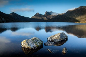
Dove Lake and Cradle Mountain. Tasmania. Australia
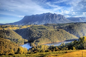
View of Mount Roland at Wilmot in Tasmania, Australia
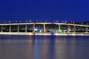
The Tasman Bridge in Hobart, TasmaniaDowntown District, Hobart, Tasmania Island, Australia
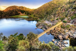
Cataract GorgeAlexandra suspension bridge over Cataract Gorge in Launceston, Tasmania
Cape Raoul`s sea cliffs of Dolerite at sunrise, Tasman National Park, Tasmania, Australia
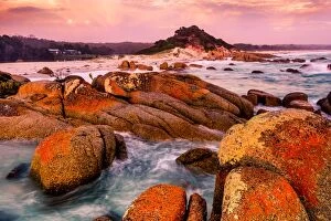
Red rock with lichen and storm cloudsBinalong bay on Tasmanians east coast has this red lichen growing over the rocks. Storm clouds pass overhead ( bay of fires)
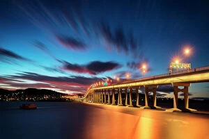
Tasman Bridge reflections at nightTasman Bridge reflected on Derwent River at night in Hobart
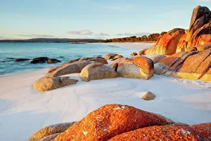
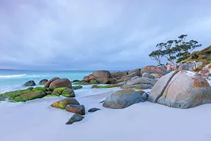
Bay Of Fires Beach Tasmania Evening SceneLining Tasmania's north-east coast, the Bay of Fires is that perfect combination of clean white beaches, clear azure seas and granite rocks splashed in orange lichen
Lichen covered rocks on the beach. Bay of Fires. Binalong Bay. Tasmania. AustraliaBay of Fires. Binalong Bay. Tasmania. Australia
Sunrise at Tessellated Pavement, Tasman Peninsula, Tasmania
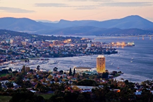
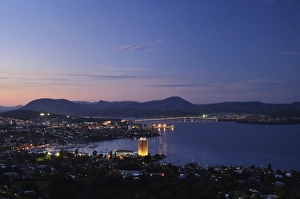
View of Hobart and River Derwent from Sandy BayThe city lights glow golden as the sun sets over Hobart
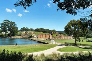
Port Arthur, TasmaniaPort Arthur Historic Site is a World Heritage listed penal colony and is the best preserved convict site in Australia, and among the most significant. Located in South East Tasmania. Australia
Dramatic light over the bay of fires in TasmaniaNeal Pritchard Photography
Eastern Coastline of Tasmania AustraliaAerial View of the Bay of Fires on the East Coast of Tasmania Australia
Aerial view of the Eaglehawk Neck in Tasmania, AustraliaEaglehawk Neck is a narrow bar between Pirates Bay to the east and Norfolk Bay to the west. It is made of sand carried by currents and waves from the floors of Pirate's Bay to the east
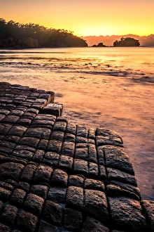
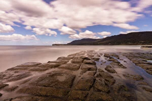
The Tessellated pavements at sunsetThe Tessellated pavements, Tasmania, Australia. These beautiful and unique formations have been created by the erosion of the changing of tides
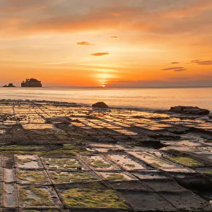
Sunrise at the tessellated pavementsthese beautiful rock formations are located in Tasmania, Australia, the erosion and the change of tides has created the tessellated pavements, patterns of rectangular or polygon blocks
Devils Kitchen, Eaglehawk Neck on the Tasman PeninsulaThis is Devils Kitchen. Located near Eaglehawk Neck on the Tasman Peninsula. Devils Kitchen is a deep trench that has been carved out by the crashing waves of the Tasman Sea
View over Pirates Bay, Eaglehawk Neck, TasmaniaView over Pirates Bay at Eaglehawk Neck in Southeast Tasmania, Australia. The spectacular rocky coast around Pirates Bay features Australia's highest marine cliffs as well as caves, chasms
Tessellated pavement, Eaglehawk Neck, TasmaniaTessellated pavement at Eaglehawk neck, Tasmania. Tessellated pavement is a naturally occurring geological phenomenon resulting in square tiled-like rock formations
View over Pirates Bay, Eaglehawk Neck, TasmaniaPirates Bay is the large bay to the east of Eaglehawk Neck. The spectacular rocky coast around Pirates Bay features Australia's highest marine cliffs as well as caves, chasms