mail_outline sales@mediastorehouse.com
1,033 items
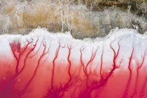
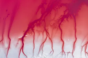
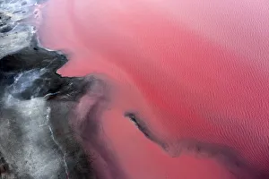
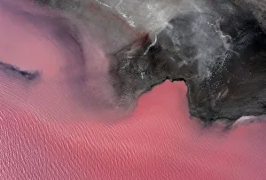
aerial view of lake TyrrellAerial top down view of the mouth of the river at Lake Tyrrell, Victoria, Australia. The lake is pink and arid/desert like. panoramic vertical view, photo taken with drone
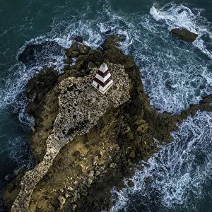
Aerial view of the Robe ObeliskThe Obelisk of the town of Robe, South Australia, Australia, id the symbol of the beautiful town. It was built on a promontory
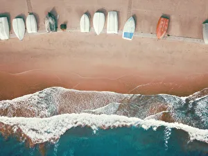
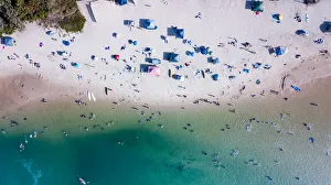
High angle view of small boats lined up on a sandy beachAerial View of Camp Cove Beach at Watsons Bay in Sydney
Aerial view of the Bay Of FiresThe beautiful Bay of Fires, Tasmania, Australia. the picture has been taken with a drone. It shows the beautiful typical red rocks, covered with lichens
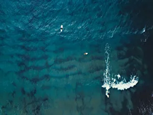
Aerial view of a group of surfers. Abstract BackgroundA group of surfers from above waiting to catch the waves
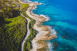
Beautiful Coastal RoadAerial photography at Great Ocean Road Australia, one of the the Worlds Most Beautiful Coastal Road
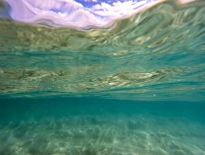
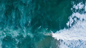
Water patterns from underneath the wave, looking up to the ocean surface, Gold Coast Australia
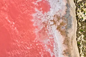
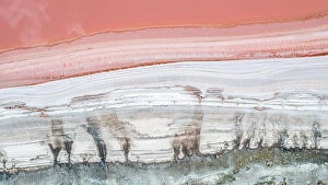
Aerial view of patterns of salty pink lake. Pink Salt Lake Hutt LagoonLas Salinas de Torrevieja
Aerial view of the salty pink lake. Pink Salt Lake Hutt LagoonHutt Lagoon
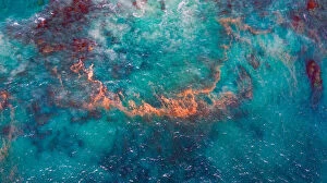
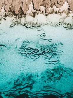
Bizarre ocean textures shot by drone, Kalbarri, Western AustraliaAerial Views
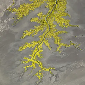
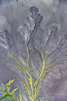
Aerial view above Wyndham of amazing natural shapes and textures created by tidal changesNature creating tree like shapes in the tidal rivers and mud flats in Wyndham WA
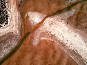
Aerial view of Kati Thanda-Lake EyreAerial view of abstract natural formations of salt, sand and water at Kati Thanda - Lake Eyre, Australias largest salt lake Its located 647 km north of Adelaide, in the state of South Australia
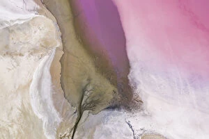
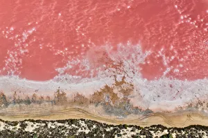
Aerial view point of the multiple colors, patterns and textures over Pink Lake watersDrone flying over Pink lakes and colorful sands. Victoria, Australia
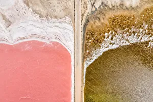
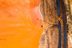
Aerial view over a pink salt lake in South AustraliaAerial view over pink salt lake in South Australia. Lake MacDonnell, Point Sinclair - South Australia
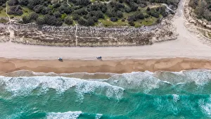
Dirt road to a nice sandy beach - Aerial viewAerial view of a dirt track leading to a nice sandy beach
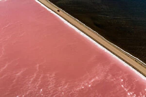
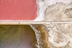
Car driving past Lake MacDonnell (Pink Lake) - AerialAerial view of a car driving past Lake MacDonnell (pink salt lake), Point Sinclair. Penong South Australia
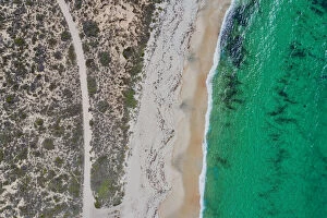
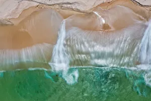
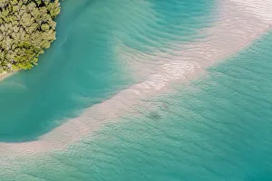
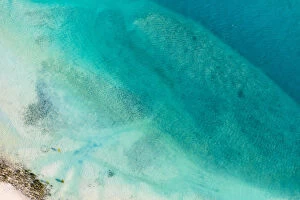
Aerial view of turquoise water crashing onto a sandy beach - Long ExposureAerial view of turquoise water crashing onto a sandy beach. South Australia Long Exposure
aerial photo of salt lake edgeabstract detail of salt lake showing natural and man made patterns
TALLEBUDGERA CREEKAncient Aborigines used to call this Gold Coast suburb " good fish" and you ll hear no argument from anyone on this apt name
Lady Elliot Island is the southernmost coral cay of the Great Barrier Reef, Australia. the island is a sanctuary for over 1, 200 species of marine life and is known for its abundance of manta rays
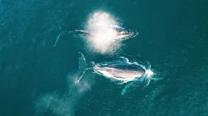
Aerial Whale PhotographThis stunning shot captured the breathtaking moment whales broke the water surface. This image captures the essence of Australias wildlife
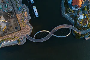
Aerial view over the footbridge at Elizabeth Quay Perth Western AustraliaNeal Pritchard Photography
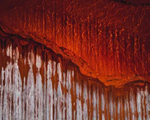
Aerial view of an bauxite tailings damBauxite tailings is a waste product generated in the industrial production of aluminium. For every tonne of alumina created, there are about two tonnes of waste
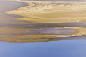
Mangrove Sand barBroome is a beach resort town in western Australias Kimberley region. Along its Indian Ocean coastline, the white sands of 22km-long Cable Beach offer a dramatic backdrop for sunset camel rides
AquaBroome is a beach resort town in western Australias Kimberley region. Along its Indian Ocean coastline, the white sands of 22km-long Cable Beach offer a dramatic backdrop for sunset camel rides
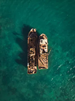
Overhead shot of two shipwrecks in Port MoresbyChris Beavon
Aerial view of Wunaamin-Miliwundi (King Leopold) Ranges rising to 300 metres above the surrounding plains (950 metres above sea level)
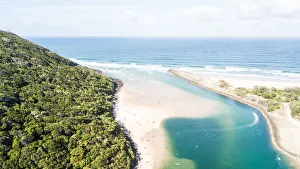
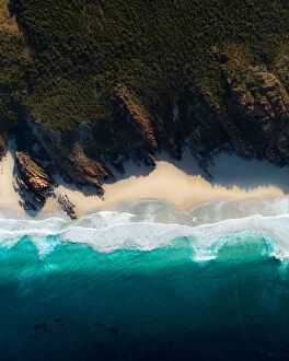
Aerial view of Moreton Island where sea meets forestA birds eye view of Cape Moreton from a helicopter with no doors looking onto beach and white sand formations
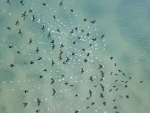
Aerial view of birds flying above the water
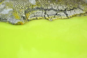
Devils BathThe deep, vivid green Sulphuric Pool named the Devils Bath. located in New Zealands active Geothermal region around Rotorua
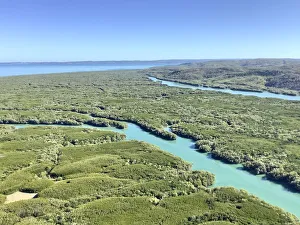
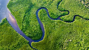
Daintree River BendsThe Daintree Rainforest, Australia
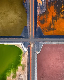
Four tailing ponds at a gas plant as seen from directly above, Western AustraliaAerial Views
Vibrant mine tailings photographed from directly above, Queensland, AustraliaAerial Views
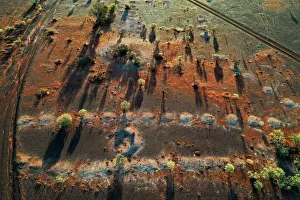
Rural landscape bushland with dusk sunlight and trees, opal mining townWhite Cliffs, NSW, Australia. Aerial photography
Aerial view of Dunsborough Western Australia
water abstractDrone imagery over Lucky bay in Cape Le Grand national park in Western Australia
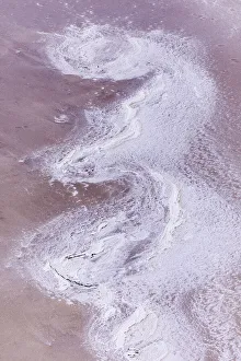
Aerial shot looking down on the shoreline of Lake Dimboola, Victoria, AustraliaAerial Views
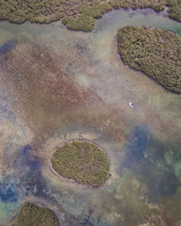
Drone perspective of a small boat in the marshlands, Shark Bay, AustraliaAerial Views