mail_outline sales@mediastorehouse.com
1,033 items
Aerial view of Shark Bay coastline as seen from directly above, AustraliaAerial Views
Mine tailings as seen from the air, Kalgoorlie, AustraliaAerial Views
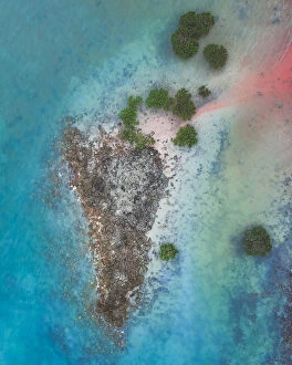
Aerial shot of tropical island, Broome, AustraliaAerial Views
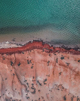
Aerial shot of Cape Peron at sunset, Shark Bay, AustraliaAerial Views
Mine tailings as seen from above, Mount Morgan, Queensland, AustraliaAerial Views
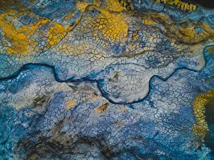
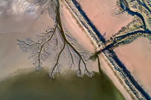
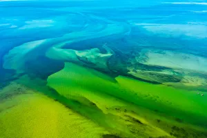
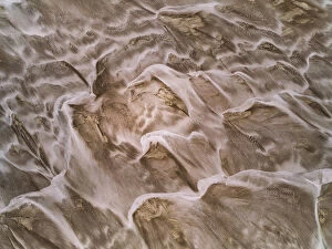
Patterns on the Noosa river bed seen from above, AustraliaAerial Views
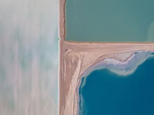
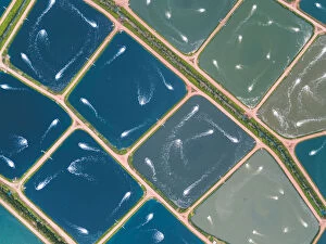
Looking down on salt storage ponds, Western AustraliaAerial Views
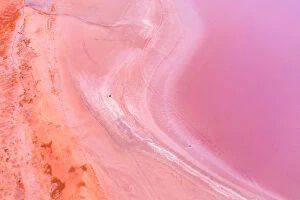
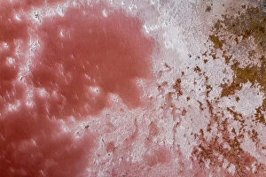
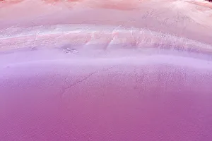
Aerial view of patterns, textures and colors, pink, purple and orange over a Pink Lake in Lochiel, South Australia
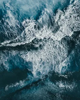
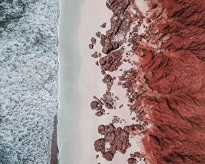
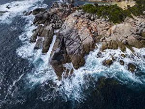
Crashing waves of the Southern Ocean photographed by drone, Esperance, AustraliaAerial Views
Drone image of salt storage ponds, Western AustraliaAerial Views
Salt Patterns in Lake MacDonnell - AerialAerial view of the salt Patterns in Lake MacDonnell, Point Sinclair. Penong South Australia
Salt Flat AerialAerial views from directly above of patterns and subjects in a salt flat
TALLEBUDGERA CREEKAncient Aborigines used to call this Gold Coast suburb " good fish" and you ll hear no argument from anyone on this apt name
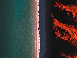
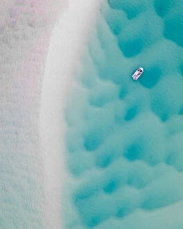
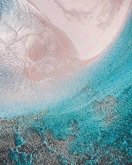
Tranquil beach scene shot from a drone, Shark Bay, AustraliaAerial Views
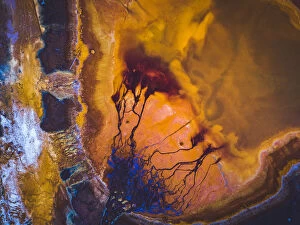
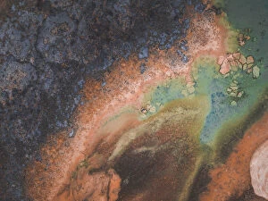
Aerial perspective at the edge of a vibrant coloured salt pool, Western AustraliaAerial Views
Boonooroo ViewOutgoing tide at Boonooroo Queensland Great Sandy Strait
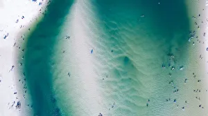
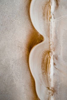
Aerial shot of a boat and river bed textures, Noosa, AustraliaAerial Views
Abstract aerial shot directly above the Noosa river, AustraliaAerial Views
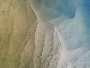
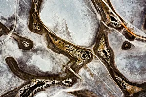
Dried up salt lake as seen from above, South AustraliaAerial Views
Windswept sand dunes shot by drone, South AustraliaAerial Views
Drone perspective directly above aquaculture ponds, Queensland, AustraliaAerial Views
Shark Bay coastline shot from a drone point of view, AustraliaAerial Views
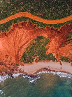
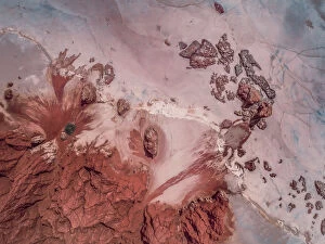
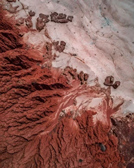
Dirt road and rock formations photographed from above, James Price Point, AustraliaAerial Views
Awe inspiring rock formations photographed by drone, James Price Point, Western AustraliaAerial Views
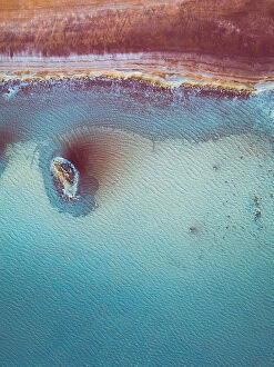
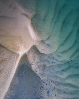
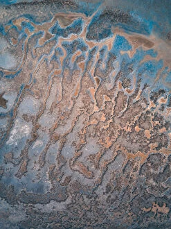
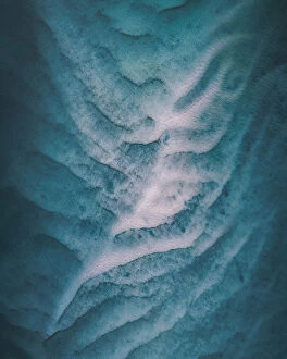
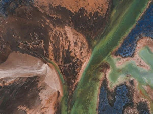
Drone image of amazing ocean floor patterns, Shark Bay, AustraliaAerial Views
Bizarre salt textures photographed by a drone directly above, Western AustraliaAerial Views
Walk Walkin Nature ReserveSalt lakes of Walk Walkin Nature Reserve, Western Australia
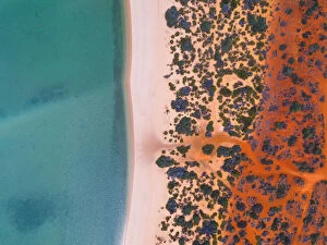
Beach and rock formations shot by drone, James Price Point, The Kimberley, AustraliaAerial Views
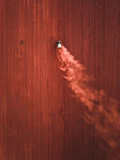
Tractor in an agricultural field photographed from above, Queensland, AustraliaAerial Views
Aerial shot of river bed textures, Noosa, AustraliaAerial Views
aerial view of autumn leaves in Shanghairedwood shot in Shanghai from an aerial view
Drone photograph of a motorboat on the Noosa river, AustraliaAerial Views
Ocean floor patterns shot by drone, Shark Bay, AustraliaAerial Views
Incredible sea floor patterns shot from above, Shark bay, AustraliaAerial Views
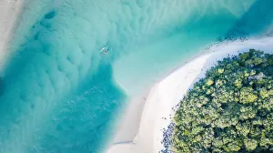
View from above of a beach and a section of the Ningaloo reef, Exmouth, AustraliaAerial Views
Rock formations on the beach shot by drone, James Price Point, The Kimberley, AustraliaAerial Views
Tallebudgera Creek Aerials (Gold Coast)A hugely popular creek on the Gold Coast, Australia used all year round for swimming, stand up paddle boarding, kayaking and other non-motorised water sports
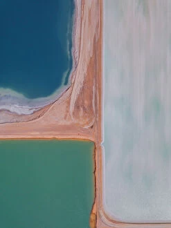
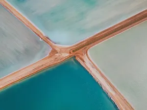
Aerial view at the centre of four salt ponds, Western AustraliaAerial Views
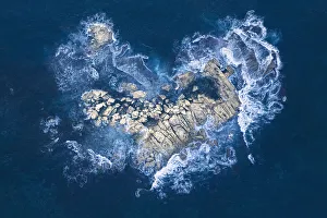
Ocean waves crashing over heart-shaped rock islanddramatic, wild, drama, love, heart, ocean, rocks, light, surface, color, w, Aerial Views
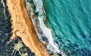
Aerial view of beach and ocean. Victoria, Australia
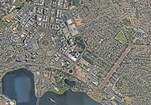
Canberra city from aboveCanberra, city view from above with infrastructure
Eastern Coastline of Tasmania AustraliaAerial View of the Bay of Fires on the East Coast of Tasmania Australia
Ocean Aerial Views, Morton Bay IslandMoreton Island is just off the coast of southeastern Queensland, Australia. This protected sand island is known for its beaches and steep dunes
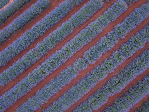
Aerial viewpoint of lavender fields and red dirtbeautiful Purple lavender Bush in full bloom as seen from a aerial photograph
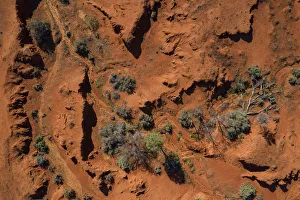
Drone point of view over the red earth of the Australian OutbackAerial point of view over red earth and bushes on the road between Lightning Ridge and White Cliff. Looking down on the drought and dry conditions of Outback Australia
Aerial view of patterns, textures and amazing colors, pink, purple and orange overAerial view of patterns, textures and colors, pink, purple and orange over a Pink Lake in Lochiel, South Australia
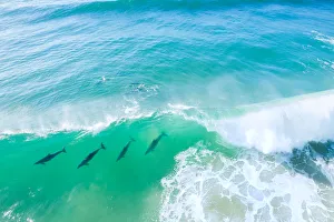
Aerial view of a pod of Dolphins swimming through a wave in the ocean, Fingal Heads, New South Wales, Australia
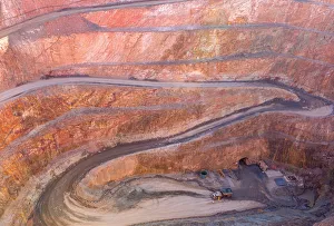
Winding Road down to the entry of a Gold Mine with a dump truck, located in Cobar NSW Australia