mail_outline sales@mediastorehouse.com
Federation Peak in Eastern Arthurs Range, Tasmania
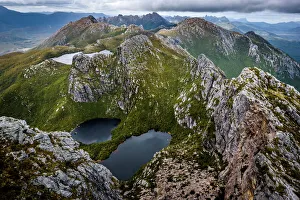
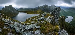
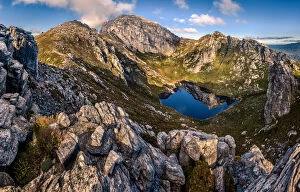
On the top of mt Scorpio in Western Arthurs Range, Southwest Tasmania. View toward Lake Vesta, Lake Juno and Promontory Lake
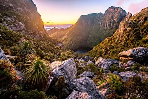
View to Lake Tahune from Franchmens Cap at sunrise. Tasmania
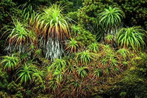
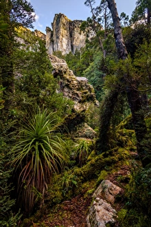
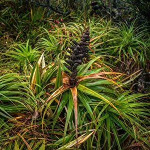
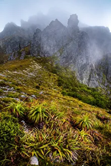
Pandani at Eastern Arthur Range, Southwest Tasmania
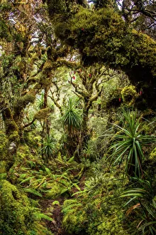
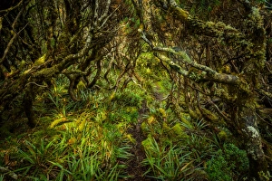
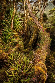
Rainforest at Goon Moor in Eastern Arthur Range, Southwest Tasmania
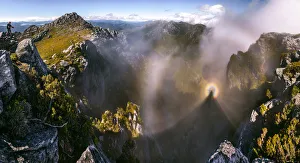
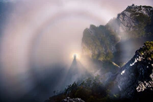
Brocken Spectre at the top of Dorado Peak in Western Arthurs RangeTaken on a side trip to Dorado Peak, in Western Arthurs Range. It was crazy weather all day here. While the Southern side of the mountains was covered in very thick fog all day
View of Eastern Arthurs Range, Lake Geeves and Hanging Lake from Geeves Bluff in Southwest Tasmania
Trail through the forest at Goon Moor in Eastern Arthur Range, Southwest Tasmania
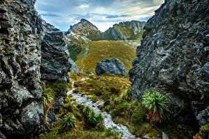
Track to Hanging Lake in Eastern Arthur Range, Southwest Tasmania
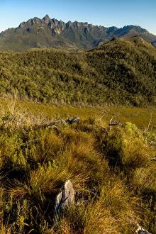
View to Federation Peak in Eastern Arthur Range, Southwest Tasmania
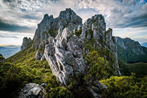
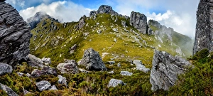
Four Peaks area in Eastern Arthur Range, Southwest Tasmania
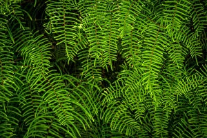
Tasmanian Fern (Doodia aspera) in Eastern Arthur Range, Tasmania
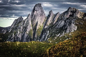
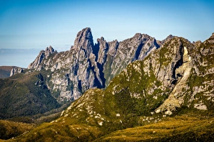
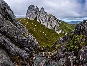
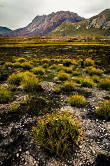
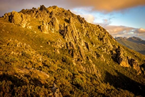
The Needles area in Eastern Arthurs Range, Tasmania
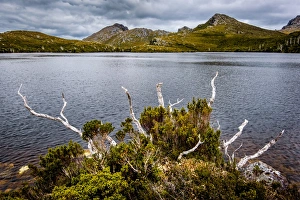
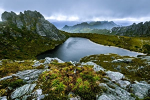
Promontory Lake in in Western Arthurs Range, Southwest Tasmania
Sunset at West Portal and view towards Western Arthurs Range, Southwest Tasmania
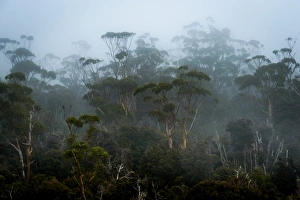
Fog in Eucalypt Forest in Southwest National Park, Tasmania
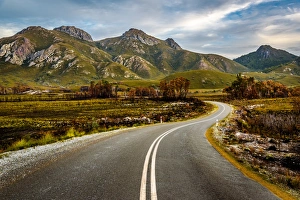
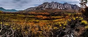
View to the Sentinel Range in Gordon River Valley after 2016 fires. Southwest Tasmania
Sharlands Peak in Track to Frenchmans Cap, Franklin-Gordon Wild Rivers National Park, Tasmania
Lions Head in Franklin-Gordon Wild Rivers National Park, Tasmania
Sunrise over Lions Head in Franklin-Gordon Wild Rivers National Park, Tasmania
View to Frenchmans Cap from North Col, Franklin-Gordon Wild Rivers National Park, Tasmania
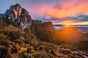
Sunrise at the top of Frenchmans Cap, Tasmania
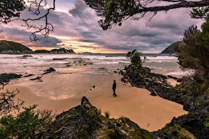
Ketchem Bay at the South West tip of Tasmania
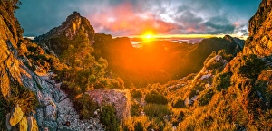
Sun rising up behind the Lions Head and Franklin River Basin on the way up to Fanchmens Cap (left and right rock walls)
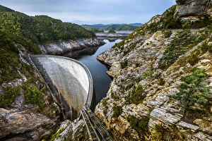
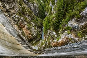
Gordon Dam in Southwest Tasmania198m long and 140m high Gordon Dam in Southwest Tasmania
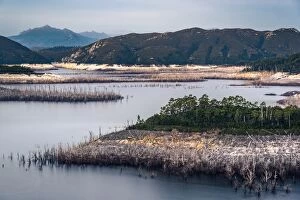
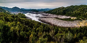
Lake Gordon in Southwest Tasmania
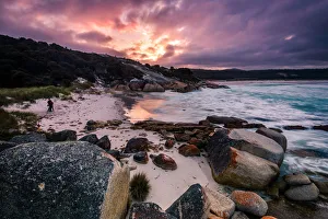
Binalong Bay at Mount William National Park, nBay of Fires, TasmaniaSunset at Binalong Bay at Mount William National Park, nBay of Fires, Tasmania
Gordon Dam in Southwest TasmaniaLooking down to 198m long and 140m high Gordon Dam in Southwest Tasmania
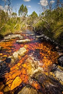
River (Pass Creek) at Arthur Plains in Southwest Tasmania
View to West Portal and Eastern Arthurs in Western Arthurs Range, Southwest Tasmania
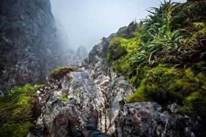
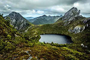
Steep track down to Lake Oberon Western Arthurs Range, Southwest Tasmania
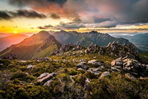
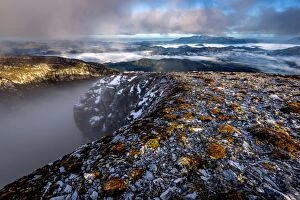
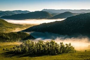
Morning fog at Southwest Tasmania. View from Eastern Arthur Range
Eastern descent from mt. Hayes in Western Arthurs Range, Southwest Tasmania
View of Hanging Lake and Eastern Arthurs Range from Geeves Bluff. Southwest Tasmania
Richea Dracophylla in Southwest Tasmania
Brocken Spectre at the top of Dorado Peak in Western Arthurs Range
View of Eastern Arthurs Range from Hanging Lake, Southwest Tasmania
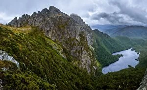
Square Lake in Western Arthurs Range, Southwest Tasmania
View to West Portal from Eastern Arthur Range, Southwest Tasmania
Lake GeevesView of Eastern Arthurs Range and Lake Geeves from Hanging Lake, Southwest Tasmania
Haven Lake in Western Arthurs Range, Southwest Tasmania