mail_outline sales@mediastorehouse.com
1,034 items
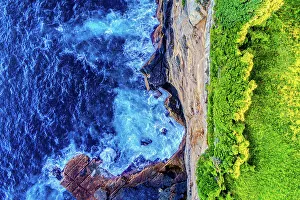
AustinmerAerial view of Austinmer, NSW, Australia
CanberraAerial view of Canberra, ACT, Australia
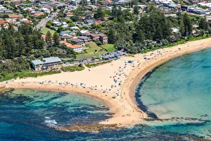
Collaroy, NSWAerial view of Collaroy, NSW
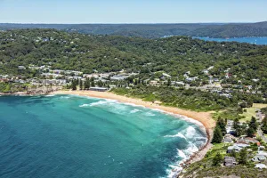
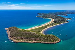
Avalon, NSWAerial View of Avalon, NSW
Dirt road between mine tailings as seen from above, Kalgoorlie, AustraliaAerial Views
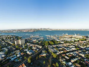
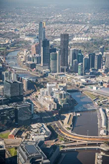
Aerial of Melbourne Central Business District from WilliamstownMelbourne Central Business District and Port Phillip Bay shot from aerial in Williamstown. Shot at sunset
Aerial view of a rowing boat surrounded by classic blue water
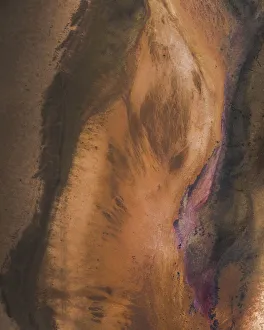
Textures of a salt lake shoreline as seen from above, Victoria, AustraliaAerial Views
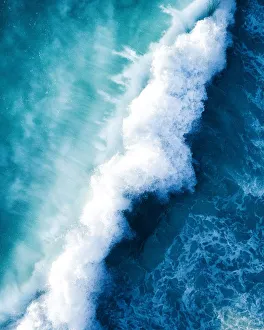
Ocean CollisionAerials, Merr Watson Aerials
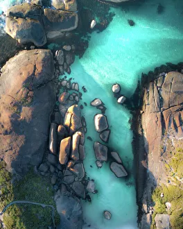
Elephant Rocks Aerial WAThe sheltered beach of Elephant Rocks in William Bay National Park, Western Australia. Its name is derived from a series of huge granite boulders which resemble a herd of elephants lumbering out to
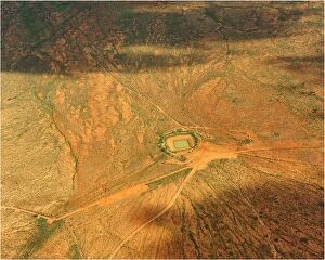
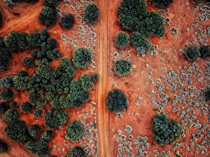
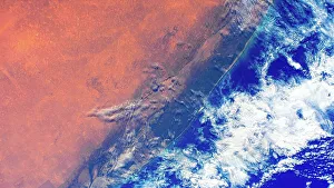
Aerial photography of the West Macdonnell Ranges west of Alice Springs, Northern Territory AustrailaAerial photography over West MacDonell Ranges, Northern Territory Australia showing the outback and desert red color
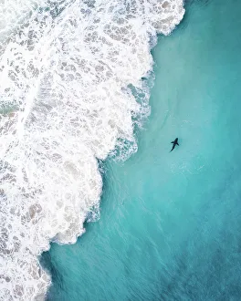
Shark SpottingAerials, Merr Watson Aerials
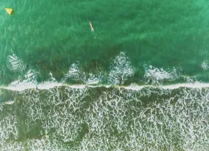
Top down Bondi bluesBlue waves and shoreline down at Bondi beach
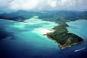
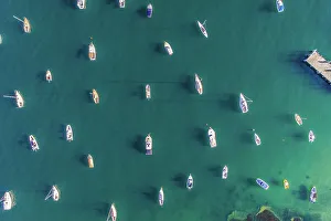
Whitsundays, Queensland, Australia. Aerial view
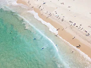
Aerial View Of Waves Splashing On Beach and People Surfing, Auckland, New ZealandAerials, 682528238
An Aerial view of the Australian outback, showing the vibrant colours of the Landscape
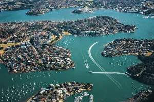
aerial view of cityscape in Sydney, buildings and river, lake, bayAerial Views
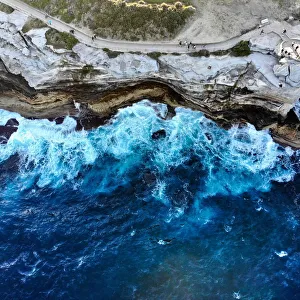
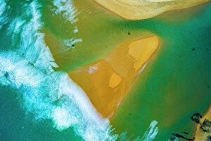
The River meets the sea, as seen from aboveThe Aerial Photo with an extended shutter release, blurs the water and waves of the river meeting the sea
Aerial photo of Sydney - Diamond Bay
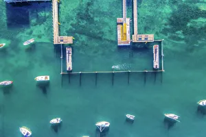
Aerial photo of Sydney - Watsons Bay boats harbour
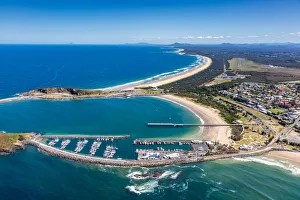
Coffs Harbour, NSWAerial view of Coffs Harbour, NSW, Australia
Toowoon Bay, NSWAerial view of Toowoon Bay Surf Life Saving Club, Central Coast, NSW
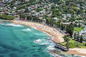
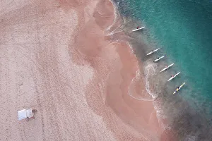
Palm Beach, NSWAerial view of Palm Beach, NSW
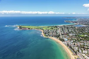
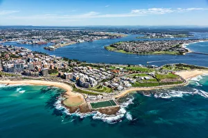
Newcastle, NSWAerial view of Newcastle, NSW
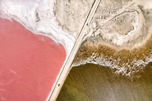
Aerial view over a pink salt lake in South AustraliaAerial view over pink salt lake in South Australia. Lake MacDonnell, Point Sinclair - South Australia
Aerial view of Surfers and people at Iconic Bondi Beach AustraliaLooking down on the crystal clear ocean with surfers and people on the beach The sweeping white-sand crescent of Bondi is one of Australias most iconic beaches
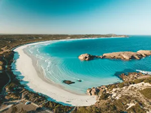
twilight cove aerialAn aerial view over twilight beach in Esperance, Western Australia
An Aerial shot of the red centre roads in the Australian Outback
Aerial view of Melbourne city, AustraliaAerial view over skylines in Central Business District of Melbourne city, Australia
Coastal Feature AustraliaCoastal feature in the South of Australia. Digital enhancement of an image from NASA. Media usage guidelines
Bondi Kayaks at SunriseAerial view of kayaks at Bondi Beach at sunrise. The sweeping white-sand crescent of Bondi is one of Australia's most iconic beaches located 7 kilometres (4 miles)
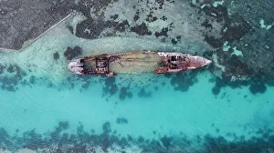
Heron Island ShipwreckThe shipwreck that dates back to the darkest days of World War Two is now a spectacular diving site off Australia's east coast
Heron Island Ray AerialThe most common rays seen around Heron Reef are the Giant Shovel-nosed Ray. Heron Island is a coral cay located near the Tropic of Capricorn in the southern Great Barrier Reef
Heron Island QueenslandAerial shots of Heron Island, a coral cay located near the Tropic of Capricorn in the southern Great Barrier Reef, 80 kilometres north-east of Gladstone, Queensland, Australia
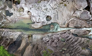
Aerial view of Babinda Creek at the Babinda Boulders Picnic groundsAerial Views
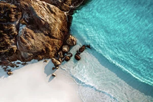
Aerial View of Little Beach, Albany Western Australia - 4K DRONE Photo
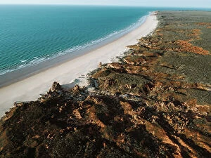
Aerial View of Broome Western Australia - Drone 4K Photo
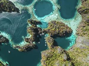
Aerial View of Twin Lagoons Coron, Philippines - Drone 4K Photo
Aerial View of Exmouth Western Australia - 4K DRONE PHOTO
Aerial View of Injidup Beach Yallingup Western Australia - DRONE 4K PHOTO
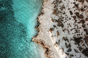
Aerial View of Kalbarri Western Australia - DRONE 4K PHOTO
Aerial View of Pinaroo Point, Hillarys Western Australia - 4K DRONE PHOTO
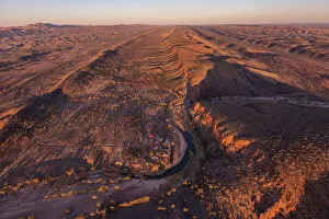
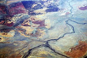
Murray Darling BasinA September 2013 aerial photo of the vast western plains of New South Wales, Australia. All rivers flow into the Murray-Darling river system which often dry out during drought seasons
An aerial viewpoint of the vast and almost empty Channel country, in south western Queensland, Outback AustraliaThe Channel Country is a region of the semi arid level to undulating part of outback Australia, situated mostly in the south western state of Queensland
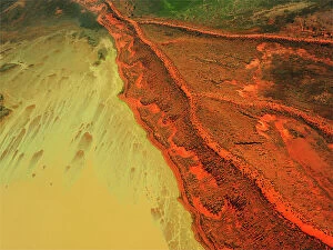
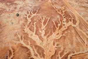
Aerial viewpoint looking down on the dry river beds and cracked earth of outback AustraliaAerial viewpoint looking down on the dramatic patterns of the dry river beds and cracked land of outback Queensland, Australia
Aerial view of Kati Thanda-Lake EyreAerial view of abstract natural formations of salt, sand and water at Kati Thanda - Lake Eyre, Australia's largest salt lake · It's located 647 km north of Adelaide, in the state of South Australia