mail_outline sales@mediastorehouse.com
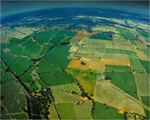
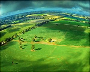
Countryside near Parkes in central New South Wales, Australia
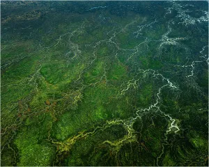
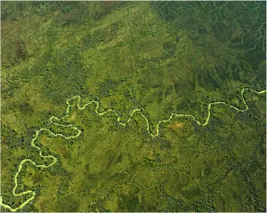
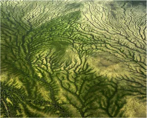
Channel countryAn aerial view of the Channel country during the wet season, outback South West Queensland, Australia
Channel countryAn aerial view of the Channel country during the wet season in outback South West Queensland, Australia
Channel countryAn aerial view of the Channel Country in outback South West Queensland during the wet season, Australia
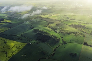
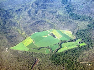
Fields of GreenAn aerial view of green pastureland in rural South West New South Wales
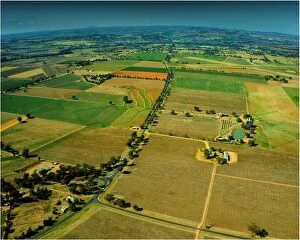
Cowra district aerialAn aerial shot of the Cowra district in New south Wales
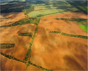
Patchwork fieldsA patchwork of fields in the river-land area of South Australia
Avon ValleyMisty spring morning above the Avon Valley, Western Australia
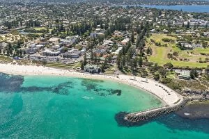
cottesloe beachaerial image of cottesloe beach with the swan river in the background
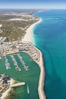
Mindarie Marina AerialMindarie marina and clayton beach aerial image
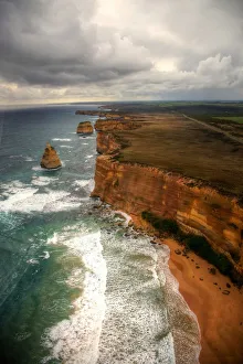
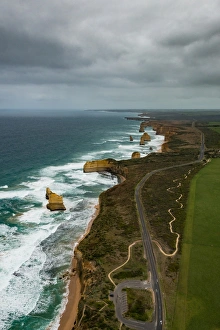
Aerial view of Great Ocean Road and 12 ApostlesGreat Ocean Road and The Twelve Apostles collection of limestone stacks off the shore of the Port Campbell National Park
Aerial view of Great Ocean Road and Twelve Apostles, Australia
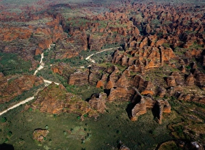
Australia, Purnululu National Park, Bungle Bungle mountain range
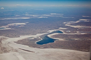
Salt lakes of central Australia
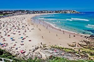
Bondi beach, Sydney, Australia
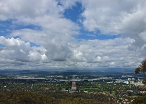
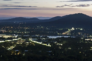
Canberra from Mount AinslieThe view over the city of Canberra, Australia, from nearby Mount Ainslie on a sunny/cloudy day showing the grid layout of the city
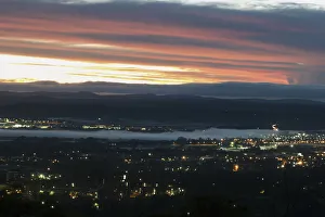
Australia, Canberra, Aerial view of downtown during sunset
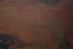
Aerial view of a dirt road positioned in a remote landscape
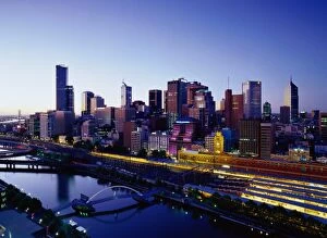
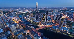
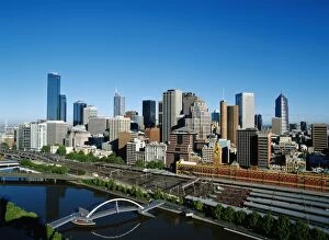
Melbourne Skyline
Downtown Melbourne at duskYarra River to downtown core of Melbourne, Australia
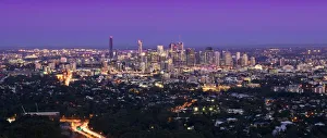
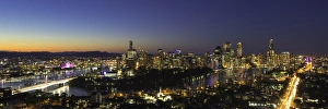
Brisbane cityscape at duskView of Brisbane cityscape at dusk
Brisbane City at duskAerial view of Brisbane city at dusk. Panorama from South Bank to the Story Bridge
Sugar canefields carved out of forestAgricultural farming block of sugar cane fields carved out of forest areas in broad flat valley in Daintree National Park
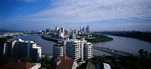
View of City in Brisbane, Australia
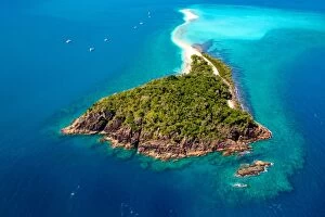
Australia, Queensland, Whitsunday Islands, forested island, aerial viewAlthough close to the Great Barrier Reef, these are not cays (coral islands) but instead continental islands; the tips of underwater islands which once formed part of the mainland until sea levels
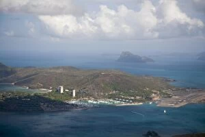
Casinos, airstrip, and yacht harbor, Hamilton Island, Whitsunday Islands, Queensland, Australia
Hardy ReefWhitsunday Islands, Australia
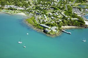
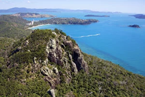
Aerial of Airlie Beach in Whitsundays, Australia. Aqua water with sailing boats
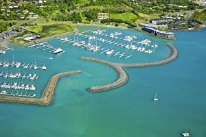
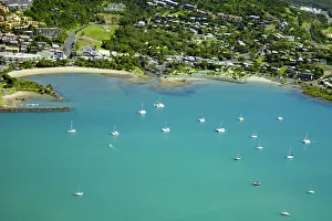
Airlie beach marinaAerial of marina port with boats in water beautiful view
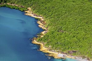
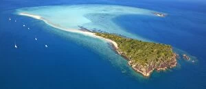
Aerial Whitsunday IslandAerial of Whitsunday Island in Australia with rain forest and ocean
Airlie beach in WhitsundaysAerial view of Airlie beach in Whitsundays, Australia. Yachts and small seaside town of Airlie Beach and turquoise water with sailing boats
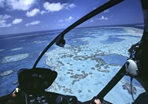
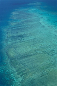
Great barrier reefGreat Barrier Reef near Whitsunday Islands from sea plane
Whitsundays
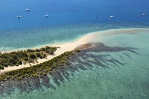
Aerial Langford Island, WhitsundaysAerial of Langford Island in Whitsundays, Queensland Australia, tropical sandy island surround by coral reefs and beautiful turquoise water
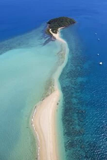
Whitsunday Islands river outletAerial view of silted river outlet with swirling sands and tropical islands, forest peninsula beach
Aerial Hamilton island whitsundaysAerial photo of Hamilton Island in Whitsundays, North Queensland Australia
Langford Island Aerial Whitsundays
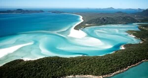
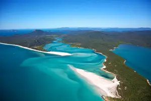
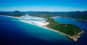
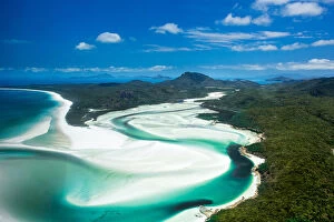
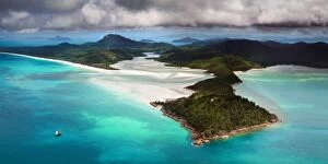
Hill Inlet PostcardReputed to be the fifth most photographed location in Australia, Hill Inlet and Whitehaven Beach are the jewels of the very beautiful Whitsundays of Queensland
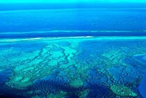
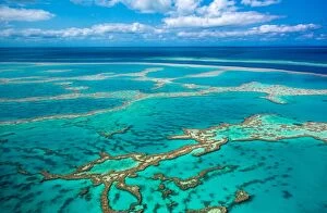
Aerial of Great Barrier Reef at Whitsunday IslandAerial photo of Great barrier reef showing reef area with some blue water and slightly cloudy sky in background
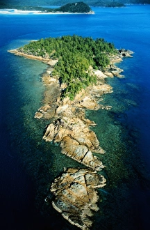
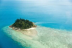
Lonely Island near Whitsunday Islands, AustraliaThis picture shows an aerial of a lonely small island near the Whitsunday Islands in Queensland, Australia
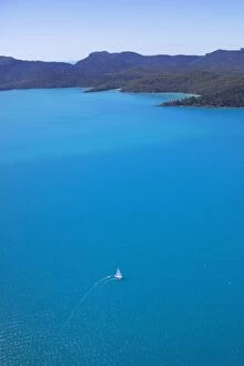
Sailing WhitsundaysOne sailing boat changing direction in the Whitsundays. Whitsunday islands positioned along the top surrounded by turquoise water with one lone yacht with its sails raised in the wind. Vertical format
Aerial Whitsundays IslandAerial photo of Langford Island in the Whitsundays, Australia. Long sandy beach surrounded by coral reefs and turquoise water that the Whitsundays are famous for
Whitehaven beachWhitehaven Beach is a 7 km stretch along Whitsunday Island. The island is accessible by boat from the mainland tourist ports of Airlie Beach and Shute Harbour, as well as Hamilton Island
Aerial of sweet water river at Whitsunday Island
Hill InletThis is an aerial image of the famous Hill Inlet on Whitshunday Island. A tall ship can be seen in the lower left hand corner of the image
Barrier Reef, Coast of Queensland, Australia