mail_outline sales@mediastorehouse.com
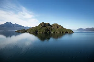
Canal Sarmiento, Magallanes & Antarctica Chilena Region
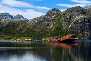
The Wreck of the SS Santa Leonor On Adelaide Rocks In Paso Shoal, Smyth Channel, PatagoniaThe Santa Leonor, formerly USS Riverside, USS Riverside (APA-102) was a Bayfield-class attack transport. During World War II, she was tasked to deliver troops to the battle front
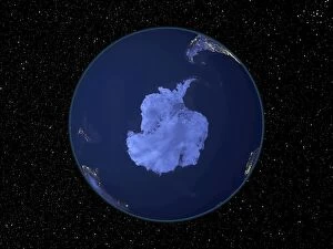
2001, Antarctica, Astronomy, City, Color Image, Digital Composite, Environment, Exploration, Globe, Hemisphere, Horizontal, Infinity, Light, Majestic, Maps And Globes, Night, No People, Photography
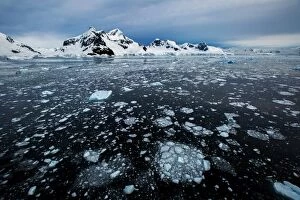
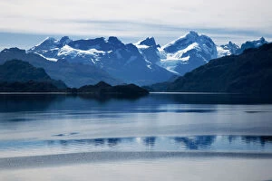
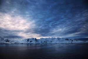
Mountain Range Along Danco Coast, West Coast Of The Antarctic Peninsula
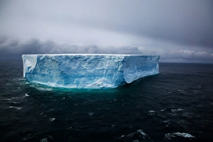
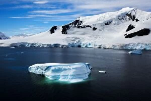
Gigantic Tabular Iceberg, Deception Bay, AntarcticaAn iceberg or ice mountain is a large piece of freshwater ice that has broken off a glacier or an ice shelf and is floating freely in open water
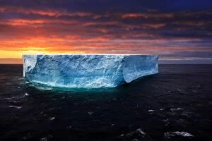
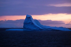
Sunset with Gigantic Tabular Iceberg, AntarcticaTabular icebergs have steep sides and a flat top, much like a plateau, with a length-to-height ratio of more than 5:1. This type of iceberg, also known as an ice island, can be quite large
Le Maire Strait via Bismarck Channel, Antarctica
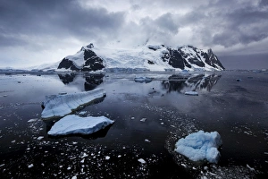
Paradise Harbor (Paradise Bay), Antarctic Peninsula, Antarctica
Sunset At Le Maire Strait, Antarctica
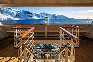
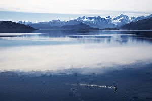
View of Mountain Ranges At Paradise Bay From Shipdeck, West Coast Of The Antarctic Peninsula, AntarcticaParadise Harbor, also known as Paradise Bay, is a wide embayment behind Lemaire and Bryde Islands in Antarctica, indenting the west coast of Graham Land between Duthiers and Leniz Points
Passing Through Wellington Island, Bernardo O Higgins National Park (Chilean Fjords), Magallanes Region, PatagoniaWellington Island is an island west of Southern Patagonian Ice Field, Chile. It has an area of 5, 556 km and most of the island forms part of Bernardo O Higgins National Park which is the largest of
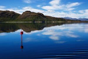
Canal Sarmiento, Magallanes & Antarctica Chilena Region. Chilean Fjords, ChileSarmiento Channel is a principal Patagonia channel, which extends in a north-south direction. It is the southward continuation of the Guia Narrows (Angostura Gu'a)
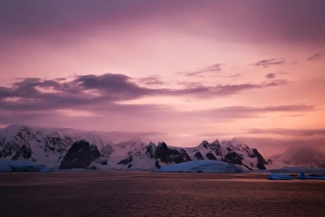
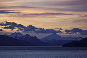
Sunset At Le Maire Straits, AntarticaThe Le Maire Strait is a strait off Antarctica, between Kiev Peninsula in the mainlands Graham Land and Booth Island. Nicknamed Kodak Gap by some
Sunset At Le Maire Strait, AntarcticaThe Le Maire Strait is a strait off Antarctica, between Kiev Peninsula in the mainlands Graham Land and Booth Island. Nicknamed Kodak Gap by some
assing Through Wellington Island, Bernardo O Higgins National Park (Chilean Fjords), Magallanes Region, PatagoniaPWellington Island is an island west of Southern Patagonian Ice Field, Chile. It has an area of 5, 556 km and most of the island forms part of Bernardo O Higgins National Park which is the largest of
Sunset with Mountain Ranges Along Strait of Magellan, in South Americas Southern TipThe Strait of Magellan (Estrecho de Magallanes), also called the Straits of Magellan, is a navigable sea route separating mainland South America to the north and Tierra del Fuego to the south
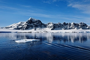
Mountain Range Along Danco Coast With a Floating Ice in the Foreground, West Coast Of The Antarctic Peninsula, Antarctica
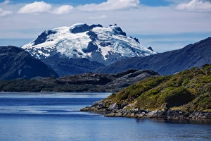
View of Snow Capped Mountain at Peel Fjord, Sarmiento Channel, Magallanes and Chilean Antarctica Region, ChilePeel Fjord is a fjord in Chile. It branches off from the Sarmiento Channel. The east side of the fjord has three side fjords, named Amalia, Asia and Calvo