mail_outline sales@mediastorehouse.com
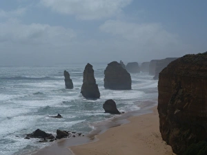
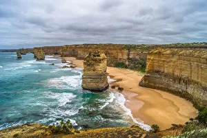
Twelve Apostles Great Ocean RoadThe famous Twelve Apostles along the Great Ocean Road in Victoria, Australia on a blue cloudy day
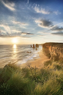
Twelve Apostles at sunset
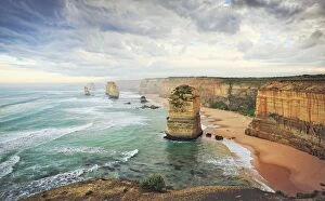
Twelve ApostlesAustralia, Victoria, Port Campbell National Park, Twelve Apostles at sunrise
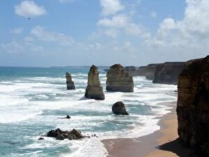
The Twelve Apostles is a collection of limestone stacks off the shore of the Port Campbell National Park, by the Great Ocean Road in Victoria, Australia
12 Apostles | Great Ocean RoadThe Twelve Apostles is a collection of limestone stacks, formed by erosion, off the shore of the Port Campbell National Park, by the Great Ocean Road in Victoria, Australia
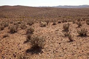
Desert Saltbush near Silverton ghost town. Silver mining country north west of Broken Hill in far western New South Wales, Australia
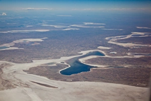
Salt lakes of central Australia
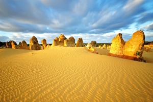
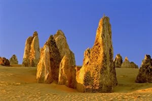
Pinnacles DesertYellow sand in Pinnacles desert in early morning at Cervantes
Australia, Western Australia, Nambung National Park, The PinnaclesThe Pinnacles are limestone pillars which tower out of the flat, sandy desert, some a few cms, some up to five metres high
Aerial view of a dirt road positioned in a remote landscape
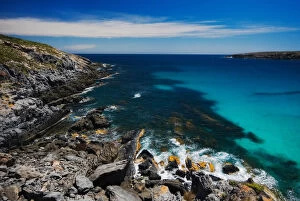
Rocks in Bay of Fires, Tasmania
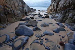
Beach with rocks, Australia
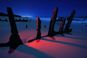
Under shifting sandDicky Beach in during cyclone. It was re-floated, but again, heavy seas turned ship about and back onto sand where it remains to this day
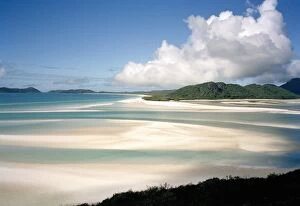
View from high up across Whitehaven Beach, Australia
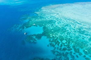
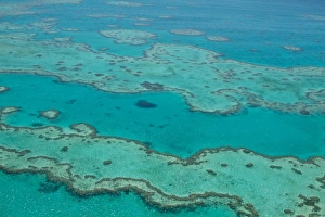
Great Barrier Reef from above by helicopterAerial shot of Great Barrier Reef with a sailing boat from helicopter cruise, Queensland, Australia
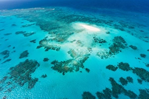
Aerial view of coral cay and Great Barrier ReefAerial shot of white coral sand cay on Great Barrier Reef from helicopter cruise, Queensland, Australia
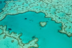
Aerial heart reef whitsundaysFamous world over, this is an aerial photograph of Heart Reef Whitsundays, heart of Great Barrier Reef
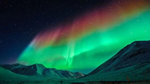
The Great Barrier of AuroraThe Great BarrierAfter waiting in -53C temperature at Atigun Pass-Dalton Highway-Alaska, the aurora has finally danced
Great Barrier Reef aerialGreat Barrier Reef is awesome from air
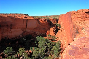
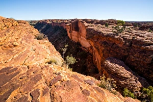
Landscape of kings canyon, in Northern Territory of Australia
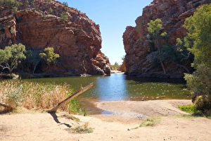
Ellery Creek Big HoleA popular summer swimming spot, situated west of Alice Springs in the West MacDonnell Ranges, Northern Territory, Australia
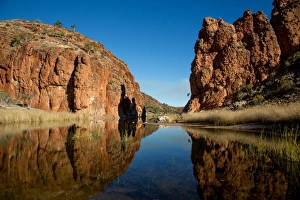
Glen Helen Gorge, Northern Territory, Australia
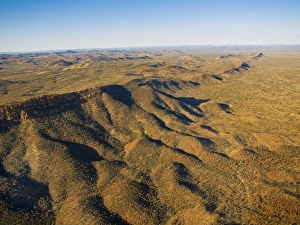
Australia, Northern Territory, Alice Springs, McDonnell Ranges, Landscape, aerial viewSep-07
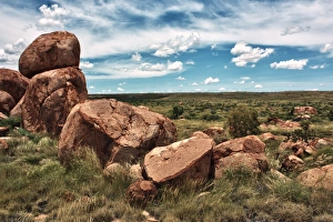
Devils Marbles in the NT. About 100km south of Tennant Creek, on the Stuart Highway
Kings Canyon. Northern Territory. AustraliaKings Canyon. Australian outback. Northern Territory. Australia
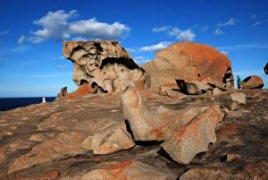
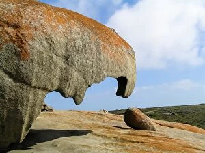
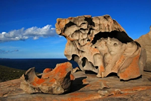
Remarkable rocks on Kangaroo IslandRemarkable Rocks, Kangaroo Island (Australia)
West Bay Kangaroo Island SAlookout pristine coast line beach ocean remote water height danger rocks sharp jagged cliffs blue sea mist
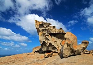
Remarkable RocksThe Remarkable Rocks can be found in Flinders Chase National Park on Kangaroo Island, Australia. They are naturally sculpted rock formations
Remarkable Rocks, Kangaroo IslandThe Remarkable Rocks on Kangaroo Island, which are naturally sculptured formations precariously balanced atop a granite outcrop. The Rocks are located in South Australia, Australia
Australia Kangaroo IslandSouth Australia Kangaroo Island, remarkable rocks
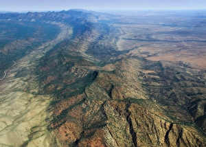
Wilpena Pound in Flinders rangesAerial patterns with haze colors of Wilpena Pound in Flinders ranges
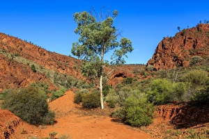
Gum tree in the Flinders Ranges. South AustraliaGum tree in the Flinders Ranges. Arkaroola. South Australia
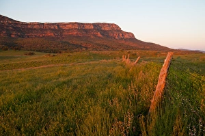
Rawnsley bluffRawnsley Bluff, Flinders Ranges, South Australia
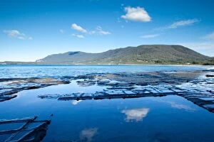
Tessellated Pavement. Tasmania. Australia
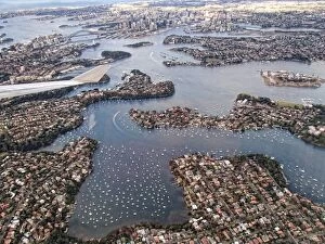
Aerial view over Sydney Harbour, Australia
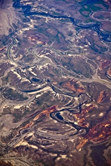
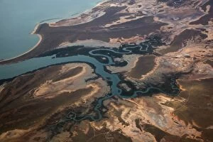
Flood plains. Outback New South Wales. AustraliaFlood plains. River systems. Outback New South Wales. Australia
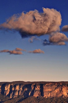
Abstract cloudSingle large cloud hovering over the Grose Valley in Blue Mountains of NSW, Australia
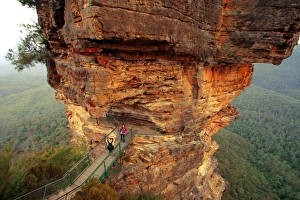
RocksThree Sisters Blue Mountains in New South Wales
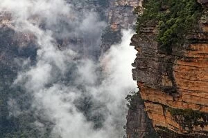
Blue MountainsSpectacular cliff with a cloudy backdrop near Wentworth Falls, in the Blue Mountains west of Sydney, Australia
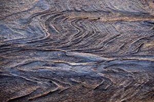
View of a rocky surface from above, Port Hedland, Western Australia, Australia
Aerial view of uncultivated landscape at the coast
View of landscape from above, Port Hedland, Western Australia, Australia
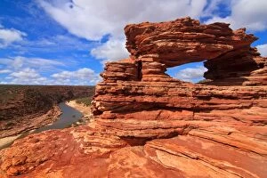
Natures WindowKalbarri National Park, Western Australia
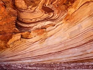
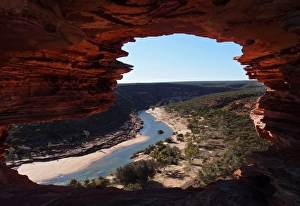
Murchison River Gorge is a riverine gorge in Mid West Western Australia. Carved by the meandering lower reaches of the Murchison River, it is more than 80 kilometres long, and up to 129 metres deep
Murchison River through Natures Window- KalbarriThe Murchison River is the second longest river in Western Australia. It flows for about 820 km from the southern edge of the Robinson Ranges to the Indian Ocean at Kalbarri
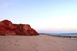
Cape Leveque Broome
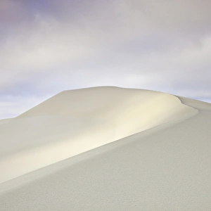
Sand dunesSunlight reflection off sand dune