mail_outline sales@mediastorehouse.com
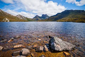
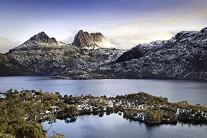
View of Cradle Mountain in the Cradle Mountain-Lake St Clair National Park, Central Highlands Region of TasmaniaThe Cradle Mountain is a mountain in the Central Highlands region of Tasmania, Australia. The mountain is situated in the Cradle Mountain-Lake St Clair National Park
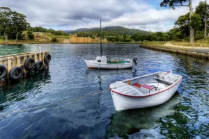
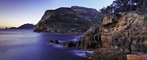
2 Boats with Port Arthur Historic Site in the Background, Tasman Peninsula, Tasmania, AustraliaPort Arthur is a small town and former convict settlement on the Tasman Peninsula, in Tasmania, Australia. Port Arthur is one of Australias most significant heritage areas and an open-air museum
Bay Of FiresAn evening image of benelong bay along the bay of fires tasmania
Honeymoon Bay Tasmaniaa perfect sunset over honeymoon bay tasmania
cliffs of Tasmaniasunrise along the cliffs on the east coast of tasmania
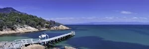
Coles Bay Boat Jetty Tasmania
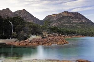
Coles Bay TasmaniaMorning shot of Coles Bay in Tasmania
Honeymoon Bay Tasmania
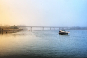
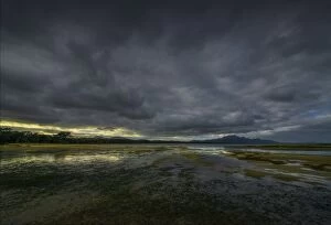
Morning mist of Devonport, Tasmania, AustraliaLonely boat and misty morning at Devonport, Tasmania, Australia
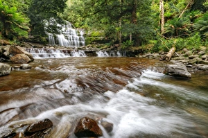
Liffey Falls in the Great Western Tiers, Midlands Region of Tasmania, AustraliaThe Liffey Falls, a series of four distinct tiered-cascade waterfalls on the Liffey River, is located in the Midlands region of Tasmania, Australia
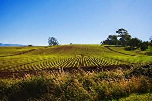
View of Clear Blue Sky with Vegetable Farm in the Foreground in Devonport, North Tasmania, AustraliaVegetable farming is the growing of vegetables for human consumption. The practice probably started in several parts of the world over ten thousand years ago
View of a Clear Day at Pirate Bay with Gum Trees in the Foreground, Eaglehawk Neck, Tasmania, AustraliaThe Eaglehawk Neck is a narrow isthmus that connects the Tasman Peninsula with the Forestier Peninsula, and hence to mainland Tasmania, Australia
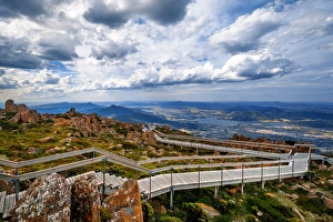
View of Greater Hobart Area From Mount Wellington, Southeast Coastal Region of Tasmania, AustraliaMount Wellington is a mountain in the southeast coastal region of Tasmania, Australia. The mountain is the summit of the Wellington Range on whose foothills is built much of the city of Hobart
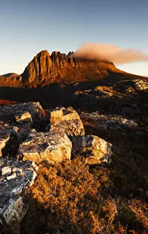
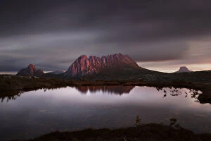
cradle mountain at sunsetcradle mountain in tasmania
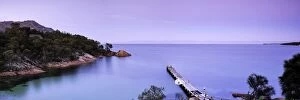
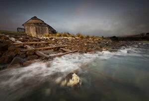
Old boat shed with waves and rocksOld boat shed abandoned on a rocky beach, waves splashing in front with misty clouds circling above
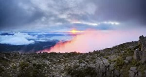
mount wellington is tasmania sunrisesunrise from mount wellington
Cradle mountain in Tasmania at sunrise
Cradle mountaincradle mountain tasmania
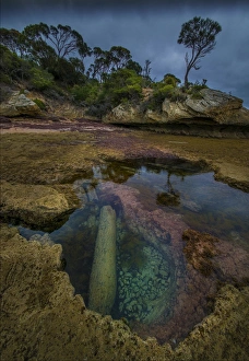
Reflections at Cave BeachCave beach has numerous rock-pools and in the bottom can be found pieces of original timber from a nearby old wharf, slowly deteriorating by storm and sea surge. flinders Island Tasmania
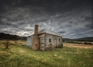
Abandoned House Sawyers BayAn old colonial cottage sits forlornly in a field near sawyers bay Flinders Island Tasmania
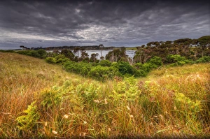
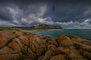
Bass straight after storm lightClouds parting after a storm passes over Bass Strait and Flinders Island Tasmania
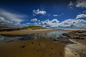
Emita Beach viewpointAt the southern end of Marshall bay is a small beach named Emita. Flinders Island Tasmania. Australia
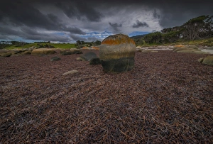
Low Tide Lillies BayAt very low tide the piles of seaweed litter the beach making a soft carpet. Lillies Beach Flinders Island Tasmania Australia
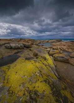
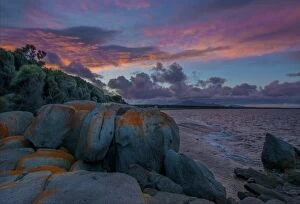
North East viewpoint Flinders IslandYellow Lichen covered rocks at the North East river estuary Flinders Island Tasmania Australia
A blue rocks sunrise Flinders IslandSunrise at Blue Rocks in Sawyers Bay Flinders Island West coast. Tasmania Australia
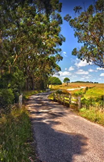
Back Road King IslandA country back road on King Island Tasmania Australia
Yarra Creek Back Road King IslandA back road through the rural farmland at Yarra Creek King Island Tasmania Australia
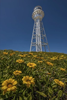
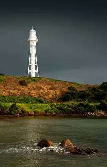
Currie lighthouse King IslandThe unique metal lighthouse in Currie Harbour King Island Tasmania Australia
Currie lighthouse in stormy weatherThe lighthouse in Currie Harbour hit with direct sunlight during a storm. King Island Tasmania Australia
View from Blow Creek estuary King IslandBlow Creek estuary and its entrance to the ocean at Sea Elephant Bay king Island Tasmania Australia
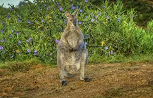
Bennetts Wallaby, King Island, TasmaniaBennetts Wallaby sits quietly in the early morning light. King Island Tasmania, Australia
Black Point SpringSpring blooms at Black Point King Island which is one of the islands that make up the state of Tasmania, Australia
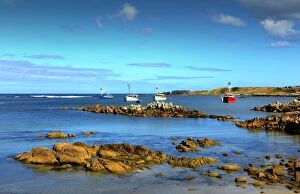
Boats at Anchor Currie HarbourFishing Boats at Anchor in Currie harbour. King Island Tasmania Australia
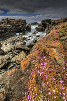
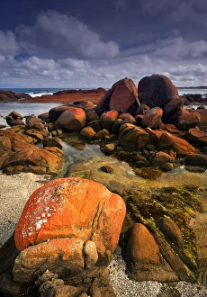
Red bBoulders at British Admirals BeachThe red coloured Ggranite boulders that cover much of the Islands coastline are particularly colourful on British Admirals beach. King Island Tasmania Australia
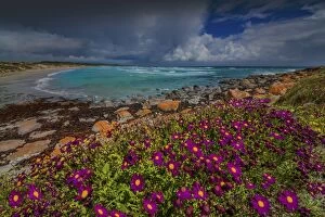
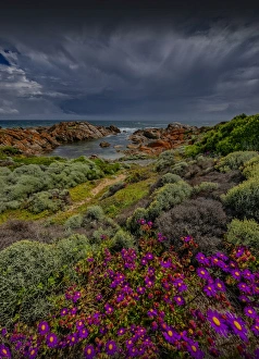
Viewpoint to British Admiral BeachSpring blooms in profusion on the coastline at British Admiral beach King Island Tasmania Australia
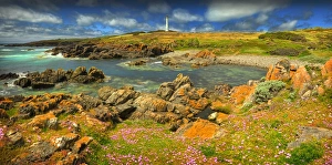
Cape Wickham Spring bloomsSpring flowers in profusion at Cape Wickham, the location of Australias Tallest Lighthouse. King Island Tasmania Australia
Blow Creek viewpointBlow Creek as it runs into the sea at Sea Elephant Bay on the east coast of King Island. Tasmania Australia
Bobs Lagoon YambacoonaIn the Northern part of King Island there are a chain of lagoons, some of them are very scenic and Bobs Lagoon at Yambacoona is no exception. Tasmania Australia
View to British Admiral beach King IslandSpring blooms dot the coastline around British Admiral beach on the West coast of King Island Tasmania Australia
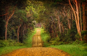
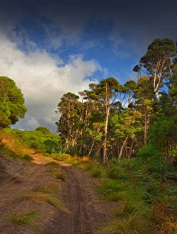
Forest Track SouthA sandy forest Track leading into the southern part of the Island. King Island Tasmania Australia
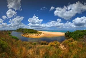
Little Grassy Bay, King IslandCoastal view of little Grassy Bay looking across to blow Point, King Island, Tasmania, Australia
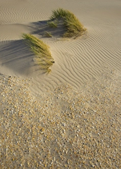
Wind patterns on Martha Lavinia BeachBeautiful wind patterns and sea-shells in the sand on Martha Lavinia Beach, which lies on the east coast of King Island. Tasmania Australia
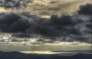
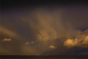
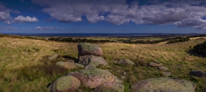
Bass Straight skiesWonderful skies over Bass Straight near Flinders Island Tasmania
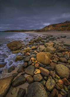
Low Tide at Sawyers BayLow tide at Sawyers Bay exposes the seaweed and makes for a soft carpet across the beach
Autumn light at the docksAn area of natural beauty, the docks on the West coast of Flinders Island, Bass straight Tasmania
View from the BluffStormy skies and reflected light at the Bluff, with views towards mount Strzelecki. Flinders Island Tasmania
View from Wireless HillThe view over the township of Whitemark and the waters of Bass Straight. Flinders Island Tasmania