mail_outline sales@mediastorehouse.com
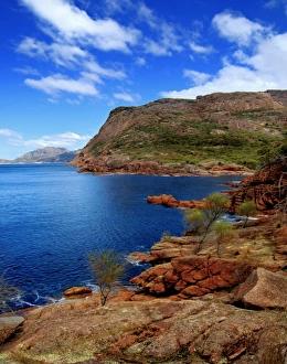
Bay viewView of bay with stunning red rock on Freycinet Peninsula in Tasmania
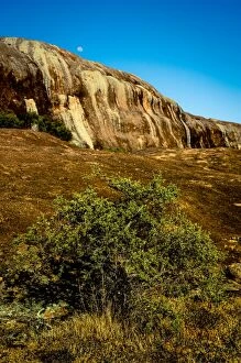
Balancing Rock at Castle Rock in Porongurup Range, Western Australia
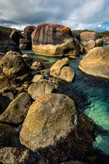
Elephant Rocks at William Bay National Park, Western Australia
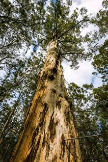
Bicentennial Tree75m tall Bicentennial Tree in Karri Forest, Western Australia
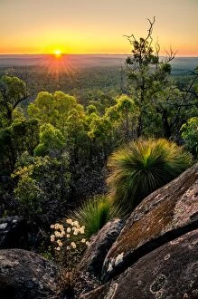
Mount DaleSunset from the top of Mount Dale. At 546 m high, it is one of the highest in the Darling Scarp in Perth area, Western Australia
The Humps near Hyden in Golden Outback, Western Australia
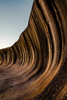
Wave Rock14 m tall and 110 m long Wave Rock in Hyden, Western Australia
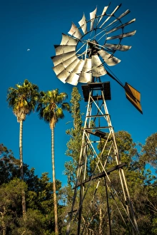
Traditional Australian WindmillTraditional australian windmill with palms and moon above it
Elephant Rocks at William BayWilliam Bay National Park, Western Australia
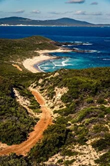
Le Grand Beach in Cape Le Grand National Park, Western Australia
View from the top of mt Le Grand in Cape Le Grand National Park, Western Australia
Point Charles in Fitzgerald River National Park
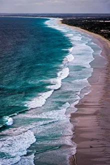
Reef Beach Dunes are 220 m high above the ocean. I found them using satellite google maps, and get there using bicicle. It was about 8 km ride
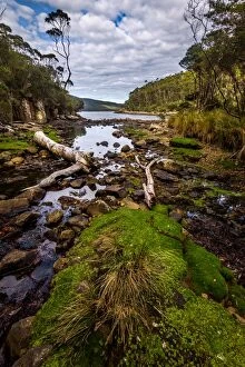
Waychinicup River in Waychinicup National Park, Western Australia
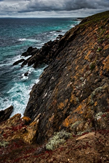
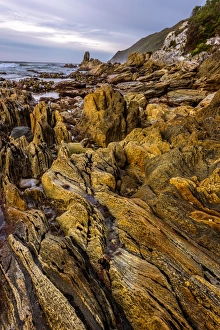
Cape Bauer at Eyre Peninsula, South Australia
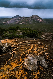
Bunyeroo Valley in Flinders Ranges, South Ausralia
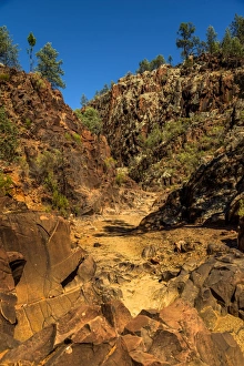
Sacred Canyon in Flinders Ranges, South Ausralia
Royal Hakea at Fitzgerald River National Park, Western Australia
View to the Parry Beach in William Bay National Park, Western Australia
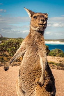
Wallaby at Lucky Wallaby in Cape Le Grand National Park, Western Australia
Binalong Bay at Bay of Fires, TasmaniaBinalong Bay at Mount William National Park, nBay of Fires, Tasmania
View to the Sentinel Range in Gordon River Valley after 2016 fires. Southwest Tasmania
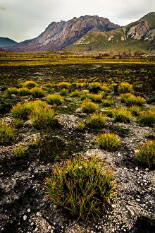
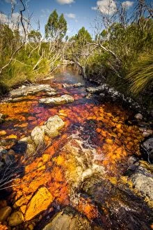
River (Pass Creek) at Arthur Plains in Southwest Tasmania
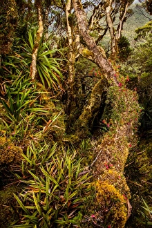
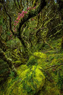
Rainforest at Goon Moor in Eastern Arthur Range, Southwest Tasmania
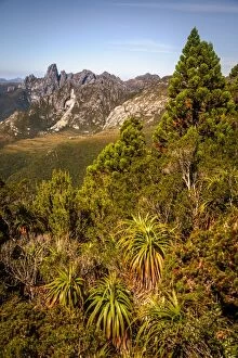
View of Eastern Arthurs Range from Hanging Lake, Southwest Tasmania
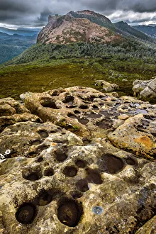
View to Federation Peak in Eastern Arthur Range, Southwest Tasmania
View to West Portal from Eastern Arthur Range, Southwest Tasmania
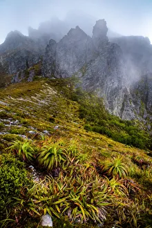
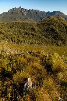
Alpine Moorland in Western Arthurs Range, Southwest Tasmania
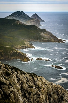
South West Cape in Southwest Tasmania
Wilson Bright, South West Cape track, Southwest Tasmania
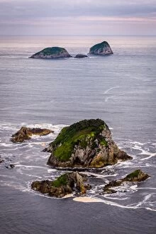
Breaksea Islands, TasmaniaAerial view of Breaksea Islands, Tasmania
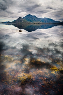
Reflection of Mt Rugby in Bathurst Harbour. Southwest Wilderness, Tasmania
View to mountt Hugel in Lake St Clair National Park, TasmaniaView to mount Hugel in Lake St Clair National Park, Tasmania
Sunset at Arthur Plains in Southwest Tasmania
Canoe Bay at Tasman Peninsula, Tasmania
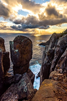
Sunset at Cape Raoul, Tasman Peninsula, Tasmania
Cape Raoul, Tasman Peninsula, Tasmania
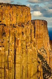
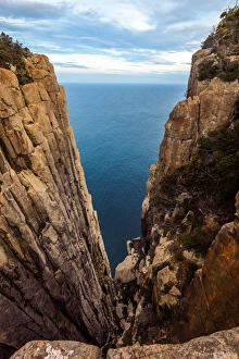
Looking down from Big Mama wall at Cape Pillar, Tasman Peninsula, Tasmania
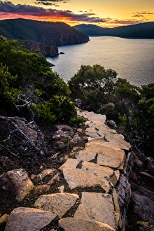
Trail to Cape HauyThree Capes Track trail to Cape Hauy at Tasman Peninsula, Tasmania
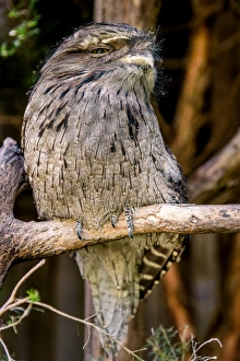
Frogmouth in Tasmania
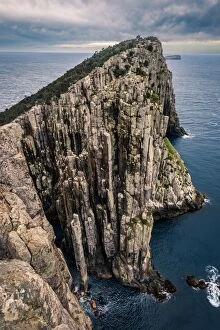
View from the top of Cape Hauy to Totem Pole
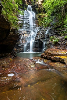
Empress Falls in Valley of the Waters, Blue Mountains, New South Wales
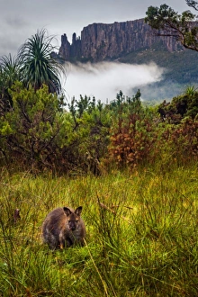
Wallaby in front of mount Oakleigh, Overland track, Tasmania
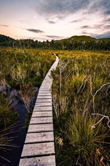
Flooded Overland track during have rains, TasmaniaOverland track, Tasmania
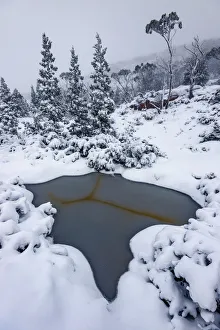
Big Snowfall at Labyrinth, Lake St Clair, Tasmania
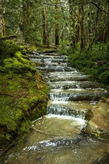
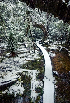
Trail at Pine Valley, Overland track, Tasmania
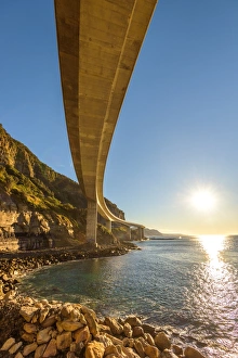
Sea Cliff Bridge, New South Wales
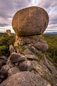
Granite boulders at the top of Cathedral Rock in Cathedral Rock National Park, New South Wales