mail_outline sales@mediastorehouse.com
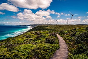
Albany Wind Farm, Western Australia
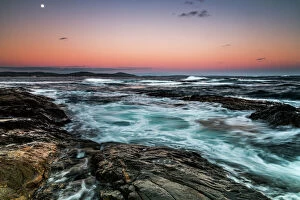
Peaceful Bay in Western AustraliaPeaceful Bay, Western Australia
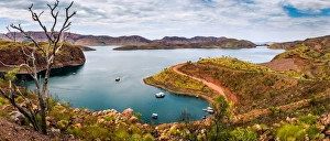
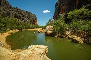
Lake Argyle, Kimberley, Western Australia
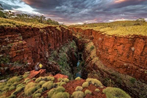
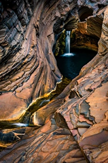
Knox Gorge at Karijini National Park, Pilbara, Western Australia
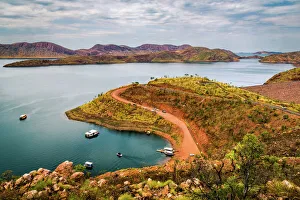
Lake ArgyleLocated 70km south of Kununurra, Lake Argyle is a massive expanse of fresh water (1000km2), the second largest in Australia and equivalent to an average of 19 Sydney Harbours
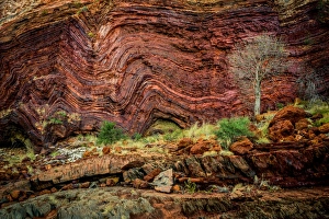
Walls of Hamersley Gorge in Karijini, Western Australia
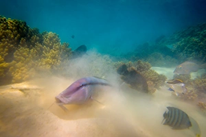
Ningaloo Reef Underwater LifeNingaloo Reef underwater life, Western Australia
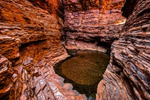
Weano Gorge, Karijini National Park, Pilbara, Western Australia
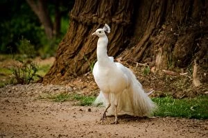
Albino PeacockAlbino peacock in Margaret River area, Western Australia
Bunda Cliffs in South Australia90m tall and 100km long Bunda Cliffs in South Australia
Waychinicup River DeltaAt Waychinicup River I did some effort scrambling around the near the inlet to get interesting perspective. As a result, at first, I stumbled into a big python
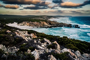
Fitzgerald River National ParkSharp Rocks along in Fitzgerald River National Park, Western Ausralia
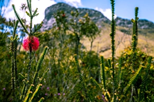
Bluff Knoll and Swamp Bottlebrush in Stirling Range, Western Australia
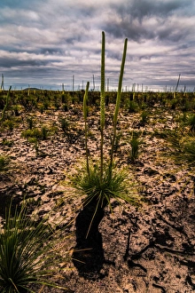
Grass trees (Xanthorrhoea or WA Black Boys) in Cape Arid National Park, Western Australia
Le Grand Beach in Cape Le Grand National Park, Western Australia
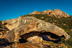
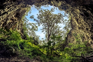
Cave HillSouth of Coolgardie, Cave Hill of Victoria Rock have similar charactistics to the famous Wave Rock. But is much more remote and also offer a few caves
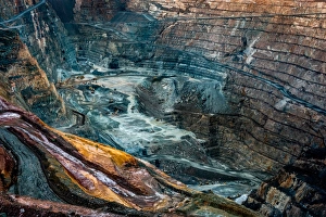
Super Pit gold mineKalgoorlie with its Super Pit gold mine is of the most the most successful towns in the Australian Outback. There have been mined 1650 tons (3 million pounds) of gold since1893
Mushroom rock at the base of Peak Charles. Peak Charles rise 500 m above the surrounding Great Western Woodlands, the largest temperate woodland
Quoin Head in Fitzgerald River National Park, Western Ausralia
Nullarbor Plain is a giant limestone karst. Flat and inhospitable, 1200 km from west to east. The main thing to experience here is different sense of scale and space
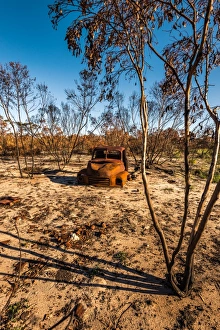
Old rusted car in the Australian Outback
Bunda Cliffs90m tall and 100km long Bunda Cliffs in Siuth Australia
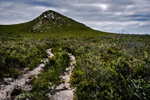
Bluff Knoll at Stirling Range, Western Australia
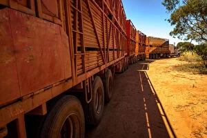
Quad Australian Road Train with four two story cattle trailers in Western Australia
Spa Pool at Karijini National Park, Western Australia
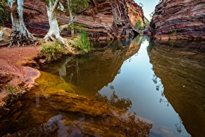
Hamersley Gorge at Karijini National Park, Western Australia
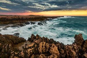
Quobba Coastline, Western Australia
Viktor Posnov Travel PhotographyAustralian Views Travel: Viktor Posnov Travel Photography
Margaret River CaveGiant karri tree at the entrance to a cave in Margaret River area, Western Australia
Hakea trail in Fitzgerald River National Park, Western Ausralia
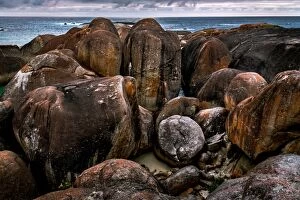
Elephant Rocks at William BayWilliam Bay National Park, Western Australia
Shore line along Hakea Trail in Fitzgerald River National Park, Western Ausralia
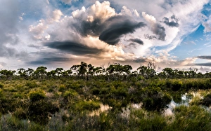
Hassell National Park, Western AustraliaDramatic sky over Hassell National Park, Western Australia
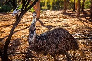
Emu in Kalgoorlie
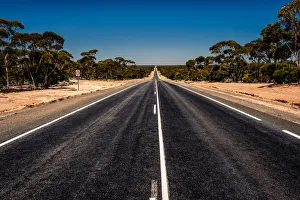
Road through Nullarbor plain in Western Australia
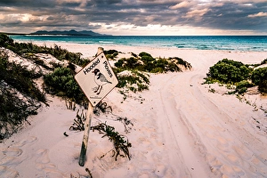
Hooded Plovers Sign at Point Charles Bay in Fitzgerald River National Park, Western Ausralia
Victoria RockSouth of Coolgardie, Cave Hill of Victoria Rock have similar charactistics to the famous Wave Rock. But is much more remote and also offer a few caves
Sunset at Hellfire BayHellfire Bay in Cape La Grand National Park
Hellfire Bay in Cape La Grand National Park
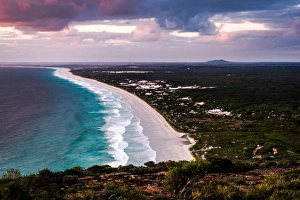
Little Tagon Bay in Cape Arid National ParkCape Arid National Park, Western Australia
View to Devils Slide from Marmabup Peak in Porongurup Range, Western Australia
Little Tagon Bay in Cape Arid National Park, Western Australia
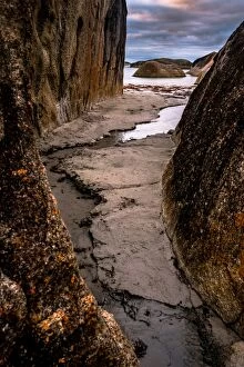
Lovers Cove in Albany, Western Australia