mail_outline sales@mediastorehouse.com
1,160 Items
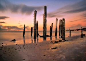
Sunset on pier ruinsRuins of Port Willunga Jetty as sunsets
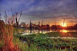
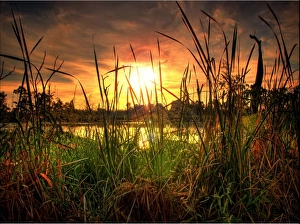
Sunset at swampHigh dynamic range image of a hot night by creek
Swamp at sunsetSunset through reeds of swamp/creek
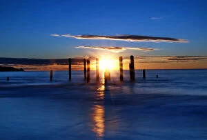
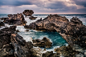
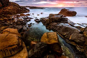
Sunset at pier ruinsStunning sunset with pier ruins and deep blue ocean
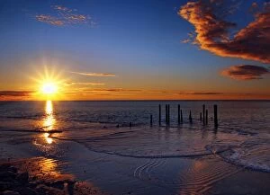
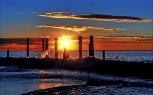
Waves at sunsetSunset over ocean through remains of old jetty
Sunset in pier ruinsView of sunshine over pier ruins
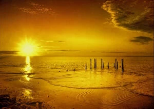
Golden sunsetBright golden sunshine over ocean highlighting the remains of old pier
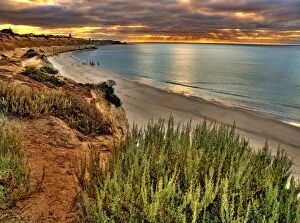
Overcast sunsetView to ocean with sun setting in distance. Cliffs line coastline
Ruins at sunsetView of Ruins against sky in Flinders Rangers, South Australia
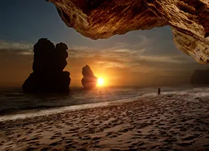
sunset capture from under the rock2 of the 12 Apostles captured at sunset from underneath the cliff base. A couple can be seen in the distance
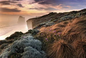
Misty BeachGreat Ocean Road view to Gibsons Beach
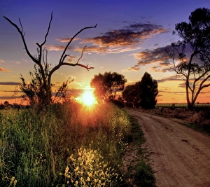
Sunset roadA lonely country path leading into a fiery sunset
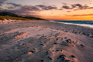
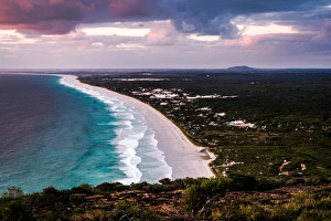
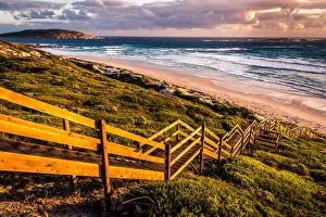
Sunset at West BeachWest Beach in Fitzgerald River National Park
Cape PeronSunset at the shoreline of Cape Peron in Perth, Western Australia
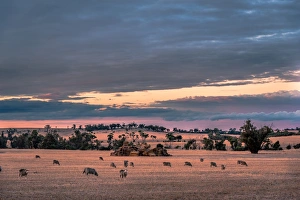
Wheatbelt Region SceneryWheatbelt region scenery. Brookton, Western Australia
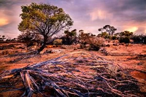
Bush, Desert, Western Australia, australia, outback, red, sunset, Viktor Posnov Travel Photography, 666064030
Animal Exercise Beach in Perth, Western Australia
Cowaramup Bay North of Gracetown, Western Australia
Mount Frankland in Western Australia
Karri Forest of southwest Western Australia is one of the tallest in the world. Karri trees can grow up to 90 m (290 ft) height, and red tingle trees could be up to 24 m (78 ft) wide
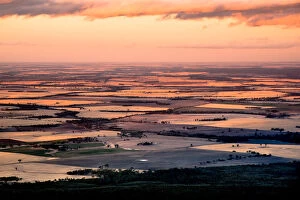
Wheat Belt plainsView to the wheat belt plains that surround Stirling Range
Stirling RangeView of Stirling Range from mt Trio, Western Australia
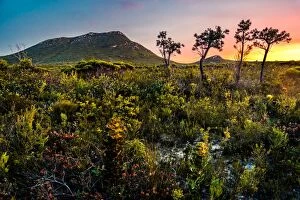
Mount DaleSunset from the top of Mount Dale. At 546 m high, it is one of the highest in the Darling Scarp in Perth area, Western Australia
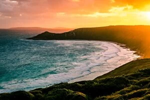
Yallingup ShorelineSunset near Yallingup. Leeuwin-Naturaliste National Park, Western Australia
Walpole WildernessView of Walpole Wilderness from Mount Frankland, Western Australia
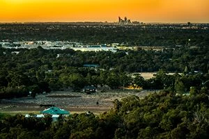
Perth Skyline from the hills with rural foregroundView of Perth Skyline from the hills with rural foreground
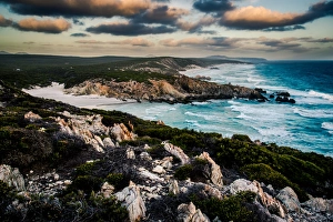
Shore line along Hakea Trail in Fitzgerald River National Park, Western Ausralia
Le Grand Beach in Cape Le Grand National Park, Western Australia
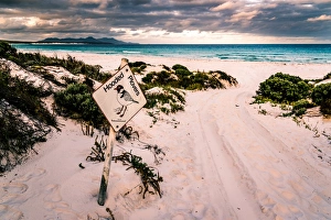
Hooded Plovers Sign at Point Charles Bay in Fitzgerald River National Park, Western Ausralia
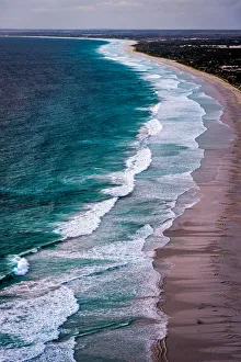
Shoreline in Cape La Grand National Park, Western Australia
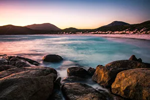
Sunset at Hellfire BayHellfire Bay in Cape La Grand National Park
Hellfire Bay in Cape La Grand National Park
Little Tagon Bay in Cape Arid National ParkCape Arid National Park, Western Australia
Little Tagon Bay in Cape Arid National Park, Western Australia
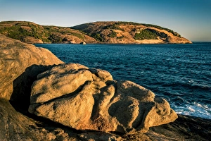
Lovers Cove in Albany, Western Australia
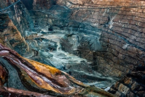
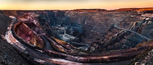
Super Pit gold mineKalgoorlie with its Super Pit gold mine is of the most the most successful towns in the Australian Outback. There have been mined 1650 tons (3 million pounds) of gold since1893
Shadows of eucalyptus trees on Victoria Rock. South of Coolgardie, Cave Hill of Victoria Rock have similar charactistics to the famous Wave Rock. But is much more remote and also offer a few caves
Shoreline along Hakea Trail in Fitzgerald River National Park, Western Ausralia
Quoin Head in Fitzgerald River National Park, Western Ausralia
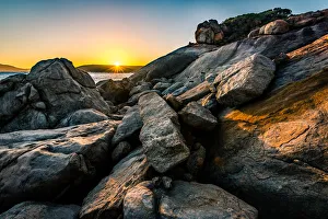
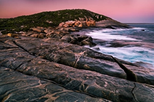
Sunset at one of the capes just off the Hakea Trail in Fitzgerald River National Park
Sunset at the top of Peak Charles in Great Western WoodlandsPeak Charles rise 500 m above the surrounding Great Western Woodlands, the largest temperate woodland
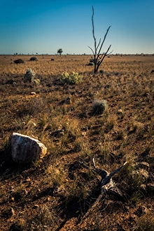
Nullarbor Plain is a giant limestone karst. Flat and inhospitable, 1200 km from west to east. The main thing to experience here is different sense of scale and space
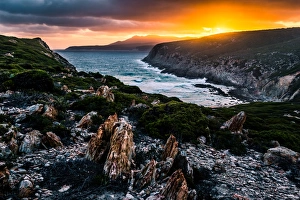
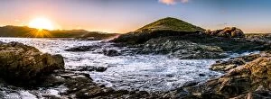
Sunset on the coastline near Denmark, Western AustraliaDenmark, Western Australia
Quaalup (West Mount Barren) in Fitzgerald River National Park, Western Australia. The park has very unique flora wich do not grow anywhere alse