
Home > Aerial Views

Aerial Views Collection (#12)

Australia's natural beauty and diverse landscape from an unusual vantage point

1,034 Items

Background imageAerial Views Collection: Satellite View of Lake Pukaki in New Zealand

Satellite View of Lake Pukaki in New Zealand
Aerial Views, ST000528

Background imageAerial Views Collection: Nullarbor Plain Australia

Nullarbor Plain Australia
Aerial Views, AB001565

Background imageAerial Views Collection: Aerial view of Melbourne city, Australia

Aerial view of Melbourne city, Australia
Aerial view over skylines in Central Business District of Melbourne city, Australia

Background imageAerial Views Collection: The Night Lights of Melbourne City, Victoria, Australia

The Night Lights of Melbourne City, Victoria, Australia
Melbourne is the capital and most populous city in the Australian state of Victoria, and the second most populous city in Australia and Oceania

Background imageAerial Views Collection: Curtain Fig Tree at Atherton Tableland, Tropical North Queensland, Australia

Curtain Fig Tree at Atherton Tableland, Tropical North Queensland, Australia
The Curtain Fig Tree is one of the largest trees in Tropical North Queensland, Australia, and one of the best known attractions on the Atherton Tableland

Background imageAerial Views Collection: Aerial Of Melbourne, Australia, 1954

Aerial Of Melbourne, Australia, 1954
Aerial view of Melbourne, the capital of Victoria, Australia, December 1954. Along the banks of the Yarra River to the left is the Flinders Street Railway Station

Background imageAerial Views Collection: Aerial view of the Port Melbourne and Princess Pier

Aerial view of the Port Melbourne and Princess Pier
Aerial view of the old famous Princess Pier located at Port Melbourne

Background imageAerial Views Collection: Aerial view of summer sea beach

Aerial view of summer sea beach

Background imageAerial Views Collection: Dam Wall Aerial

Dam Wall Aerial
Patterns at the edge of a dam wall

Background imageAerial Views Collection: Atherton Tablelands

Atherton Tablelands
Aerial view of a creek through rolling hills with trees and ferns amongst the cattle tracks

Background imageAerial Views Collection: Hot Air Balloon Views

Hot Air Balloon Views
Abstract view of red dirt fields, near Northam, Western Australia

Background imageAerial Views Collection: Barron River

Barron River
This aerial photo shows the lower reaches upstream from the delta of the Barron River, near Cairns, Queensland, Australia

Background imageAerial Views Collection: Aerial view over the west McDonnell ranges, Central Australia

Aerial view over the west McDonnell ranges, Central Australia
Northern Territory, Australia

Background imageAerial Views Collection: Mud Flats Near Derby at Kimberley in Western Australia

Mud Flats Near Derby at Kimberley in Western Australia

Background imageAerial Views Collection: Quake Line

Quake Line
Fissures caused by an earthquake, running through the Great Eastern Highway and surrounding wheat fields near Meckering, Western Australia

Background imageAerial Views Collection: Gulf of Carpentaria

Gulf of Carpentaria
Typical scene across Gulf of Carpentaria

Background imageAerial Views Collection: Aerial view of coastline and harbour Kiama

Aerial view of coastline and harbour Kiama
View from plane of Kiama harbour, lighthouse and coastline in Australia 2012

Background imageAerial Views Collection: St. Marys Cathedral

St. Marys Cathedral
Aerial view of Sydney St. Marys Cathedral

Background imageAerial Views Collection: horizontal, color, photography, no people, outdoors, day, aerial view, natural pattern

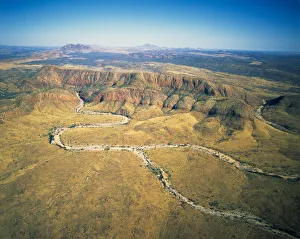
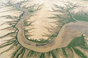
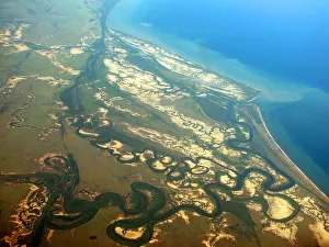
horizontal, color, photography, no people, outdoors, day, aerial view, natural pattern, uncultivated land, arid climate, absence, ideas, nature, tranquil scene, scenics, physical geography

Background imageAerial Views Collection: Sand Dune Aerial

Sand Dune Aerial
Aerial patterns of a sand dune with eroded ridgelines

Background imageAerial Views Collection: Sediment laden waters

Sediment laden waters
Seawaters off mainland coast of Australia, showing varying degrees of sediment load spread around jagged coastline by nearshore currents

Background imageAerial Views Collection: Eucalyptus forest at sunset, Australia, aerial view

Eucalyptus forest at sunset, Australia, aerial view
Mount Ramsey, Wilsons Promonotory National Park, Victoria, Australia

Background imageAerial Views Collection: Australia, Western MacDonnell Ranges, aerial view

Australia, Western MacDonnell Ranges, aerial view
date: 2000_6_15 | restrictions end date: | date created: 2006:06:05

Background imageAerial Views Collection: Lake Argyle

Lake Argyle
A photo of the dam wall at Lake Argyle, Western Australia taken from a light aircraft

Background imageAerial Views Collection: Mount Mulligan

Mount Mulligan was a mining town in northern Queensland, Australia, the site of Queenslands worst mining disaster. It was a coal mining town from 1910 until 19 September 1921 when an underground

Background imageAerial Views Collection: Australia, Western Australia, Indian Ocean, Houtman Abrolho

Australia, Western Australia, Indian Ocean, Houtman Abrolho
Beauty In Nature, Aerials, 200565401-001

Background imageAerial Views Collection: Aerial view near Cairns, North Queensland, Australia

Aerial view near Cairns, North Queensland, Australia
Aerials, 501563536

Background imageAerial Views Collection: Aerials

Aerials
Australian Views Aerials

Background imageAerial Views Collection: Aerials

Aerials
Australian Views Aerials

Background imageAerial Views Collection: East and West Ningaloo

East and West Ningaloo
Aerial View of the Ningaloo Reef in Western Australia and the Cape Range National Park where the desert meets the sea from a birds eye view

Background imageAerial Views Collection: Narrabeen Beach, Sydney, Aerial Photography

Narrabeen Beach, Sydney, Aerial Photography
Sydneys iconic beaches

Background imageAerial Views Collection: View of Cape Range National Park

View of Cape Range National Park
Sunset view of Cape Range National Park at Exmouth

Background imageAerial Views Collection: High angle view of Geraldton

High angle view of Geraldton
A high angle view of Geraldton, Australia

Background imageAerial Views Collection: View 1 of Abrolhos Islands

View 1 of Abrolhos Islands
High angle view of houtman abrolhos islands

Background imageAerial Views Collection: View 2 of Abrolhos Islands

View 2 of Abrolhos Islands
High angle view of houtman abrolhos islands

Background imageAerial Views Collection: View of Geraldton

View of Geraldton
High angle view of geraldton, Australia

Background imageAerial Views Collection: Aerial view, Australia, Bay, Boats, City, Cityscape, New South Wales, Outdoors, Overhead View

Aerial view, Australia, Bay, Boats, City, Cityscape, New South Wales, Outdoors, Overhead View, Photography, Pyrmont, Sydney

Background imageAerial Views Collection: australia ocean jetty

australia ocean jetty
Aerial drone images above Coogee beach in Western Australia

Background imageAerial Views Collection: Vivonne Bay Jetty

Vivonne Bay Jetty
Sky High view of the jetty near sunset

Background imageAerial Views Collection: Flying High over the Tangalooma Wrecks Queensland

Flying High over the Tangalooma Wrecks Queensland
Helicopter Aerial

Background imageAerial Views Collection: No People, Horizontal, Outdoors, Day, Aerial View, Directly Above, Nature, Tropical Climate

No People, Horizontal, Outdoors, Day, Aerial View, Directly Above, Nature, Tropical Climate
DCIM100MEDIADJI_0333.JPG

Background imageAerial Views Collection: Bridal Veil Falls

Bridal Veil Falls in the Blue Mountains region of NSW

Background imageAerial Views Collection: Green Seas

Green Seas
Surfers at Cronulla Beach

Background imageAerial Views Collection: Aerial View of Hobart

Aerial View of Hobart, Tasmania

Background imageAerial Views Collection: Australia from above

Australia from above
orange sand and turquoise ocean water, Western Australia. Aerial top down view. Broome, Kimberley. Crab Creek Road

Background imageAerial Views Collection: Aerial view along the South Australian coastline just south of Point Lowly where the giant

Aerial view along the South Australian coastline just south of Point Lowly where the giant cuttlefish migration
Aerials, 862645694

Background imageAerial Views Collection: Canberra city from above

Canberra city from above
Canberra, city view from above with infrastructure

Background imageAerial Views Collection: Australia, New South Wales, Bermagui, Sea and beach

Australia, New South Wales, Bermagui, Sea and beach
scenics, leisure, clear, bermagui, Aerials, 936301986


All Professionally Made to Order for Quick Shipping