mail_outline sales@mediastorehouse.com
Victoria cove, King Island, Bass Strait, Tasmania, Australia
Summer blooms, Cape Wickham, King Island, Bass Strait, Tasmania, Australia
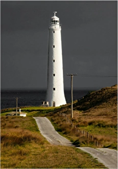
Cape Wickham lighthouse, King Island, Bass Strait, Tasmania, Australia
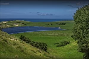
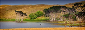
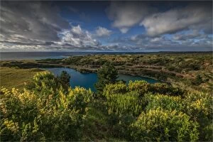
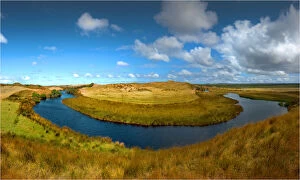
Wickham lake, King Island, Bass Strait, Tasmania, Australia
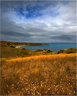
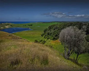
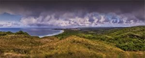
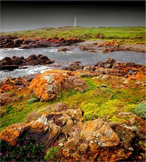
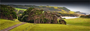
Rural view towards cape Wickham, King Island, Bass Strait, Tasmania, Australia
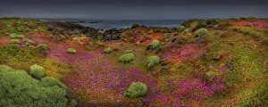
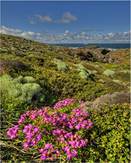
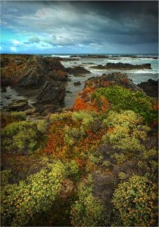
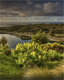
Spring blooms at Devils Gap, King Island, Bass Strait, Tasmania, Australia
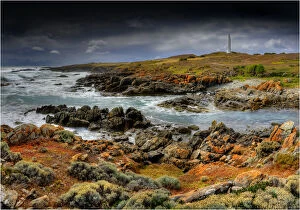
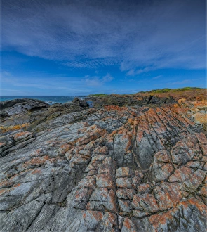
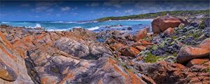
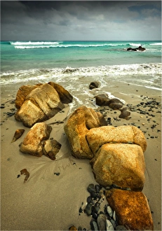
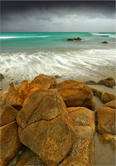
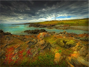
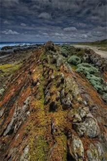
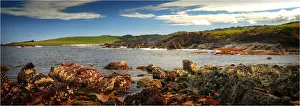
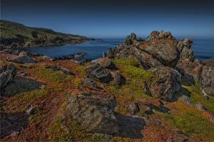
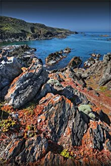
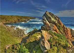
Rocky coastline, King Island, Bass Strait, Tasmania, Australia
Rural view near Gentle Annie, King Island, Bass Strait, Tasmania, Australia
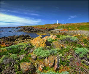
View to Wickham lighthouse, King Island, Bass Strait, Tasmania, Australia
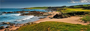
Coastal views, near Half Moon bay, King Island, Bass Strait, Tasmania, Australia
British Admiral beach, King Island, Bass Strait, Tasmania, Australia
Coastal views, towards Black point and Colliers beach, King Island, Bass Strait, Tasmania, Australia
View to Currie lighthouse, King Island, Bass Strait, Tasmania, Australia
Yarra Creek road, in rural King Island, Bass Strait, Tasmania, Australia
Yellow rock beach, eastern coastline of King Island, Bass Strait, Tasmania, Australia
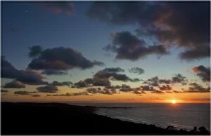
Bold head sunriseA sunrise appears over Bass Strait at Grassy on King island, Tasmania
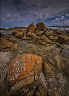
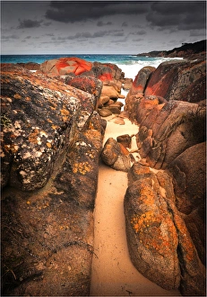
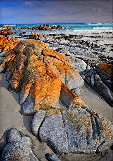
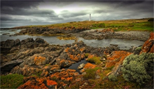
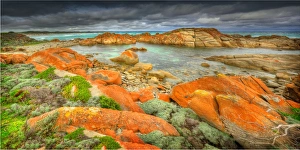
Sandblow point GrassyThe red Lichen covered rocks at Sand-blow point near Grassy on King Island, Bass Strait Tasmania
British Admiral beach on King island, bass strait Tasmania
British Admiral beachA view of British Admiral beach, popular with the locals as a relatively safe swimming area on King island near Currie, bass strait Tasmania
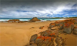
British Admiral rocky coastlineBritish Admiral beach and the rocky rugged terrain to be found in this area. Bass Strait, king island Tasmania
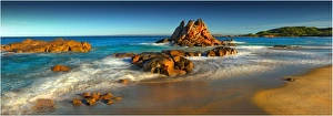
Broken arm beachA panoramic view of Broken arm beach on the East coastline of King island, bass strait Tasmania
British Admiral BeachA view of British Admiral Beach on King Island in bass Strait. Part of the Tasmanian Islands
Broken arm beachBeautiful and wild Broken Arm beach in a rugged and remote corner of King island. Very few people visit this special beach
Broken Arm beachA view to the beautiful and remote Broken Arm beach on King island Tasmania
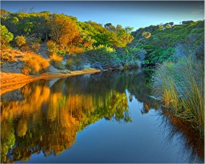
Broken Arm Creek and beautiful reflections from afternoon light. king Island, bass Strait Tasmania
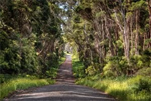
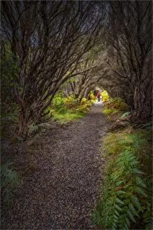
Bushland TrackA bushland Track on king Island Tasmania
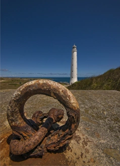
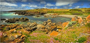
Cape WickhamA view towards Cape Wickham and the Lighthouse on King Island Tasmania
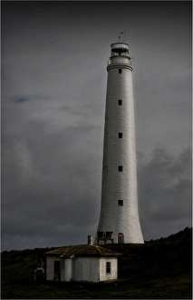
The lighthouse at Cape WickhamA view to Cape Wickham, with is home to the tallest lighthouse in the southern hemisphere
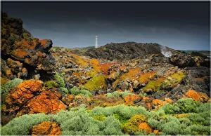
Storm at Cape Wickham, King Island Tasmania
Cape Wickham lighthouseA panoramic view of Cape Wickham, with views to the tallest lighthouse in the southern hemisphere
Cape Wickham viewA view to Cape Wickham, King island Bass Strait Tasmania
Cape WickhamThe lighthouse at Cape Wickham on King Island, Tasmania
Cape Wickham lighthouseA view of Cape Wickham, with views to the tallest lighthouse in the southern hemisphere, situated on King islands coastline
Cask lakeA panoramic view of Cask lake in the northern area of King island, Bass Strait Tasmania
Coastline near the Cataraqui shipwreckThe coastline near where the Cataraqui shipwreck lies on King island. Australias worst peacetime maritime disaster
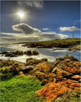
Summer at Cape WickhamCoastal view on a summers day at Cape Wickham, King Island. The lighthouse built of local granite is the tallest in the Southern Hemisphere and is located in Bass Strait, Tasmania
View to the flooded Scheelite mine, Grassy, King Island, Bass Strait, Tasmania
City of Melbourne Bay, named after a shipwreck, is a beautiful small cove on the Eastern coastline of King Island, Bass Strait, Tasmania
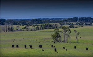
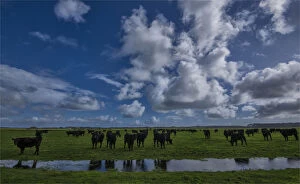
A herd of Black Polls at a watering hole, on the lush pastures of King Island, Bass Strait, Tasmania
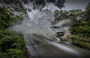
Driving through water on King Island, Bass Strait, Tasmania, Australia
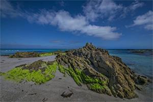
Seal Rocks, King Island, Bass Strait, Tasmania, Australia
Seal River, King Island, Bass Strait, Tasmania, Australia
Sheltered cove on the coastline of King Island, Bass Strait, Tasmania, Australia