mail_outline sales@mediastorehouse.com
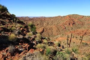
4x4, Arkaroola, Australia, Australian, blue, dry, Flinders Ranges, four wheel driveAustralia
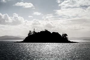
Hamilton Island. Queensland. Australia
Hamilton Island. Queensland. AustraliaHamilton Island on the great barrier reef. Queensland. Australia
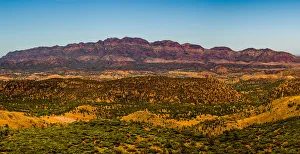
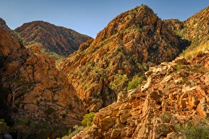
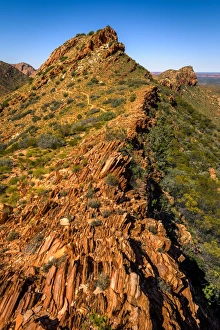
View of Elder Range from the top of Wilpena Pound in Flinders Ranges, South Ausralia
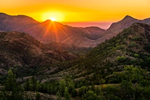
Sunset at St Mary Peak, the highest mountain of Wilpena Pound, a natural amphitheater of mountains in Flinders Ranges
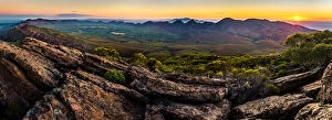
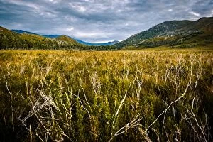
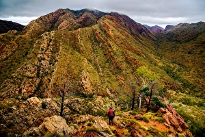
Bunyeroo Valley in Flinders Ranges, South Ausralia
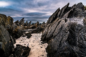
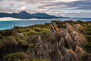
Shore line along Hakea Trail in Fitzgerald River National Park, Western Ausralia
Shoreline along Hakea Trail in Fitzgerald River National Park, Western Ausralia
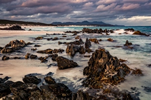
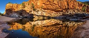
Sunset at Fitzerald Beach at Mamang trail in Fitzerald River National park in Western Australia
Point Charles and Fitzerald Beach in Fitzerald National Park, Western Australia. View from Mamang trail
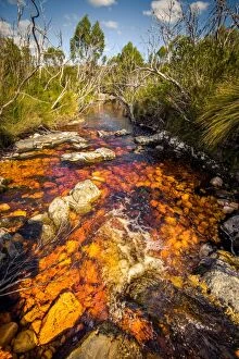
River (Pass Creek) at Arthur Plains in Southwest Tasmania
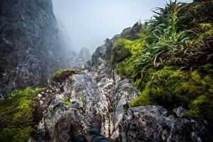
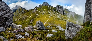
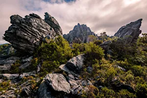
Steep track down to Lake Oberon Western Arthurs Range, Southwest Tasmania
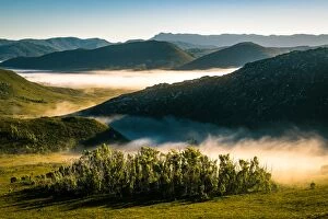
Morning fog at Southwest Tasmania. View from Eastern Arthur Range
Eastern descent from mt. Hayes in Western Arthurs Range, Southwest Tasmania
View to Federation Peak in Eastern Arthur Range, Southwest Tasmania
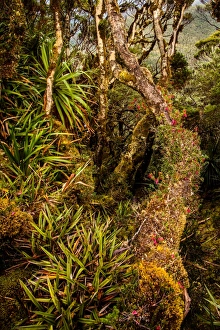
Rainforest at Goon Moor in Eastern Arthur Range, Southwest Tasmania
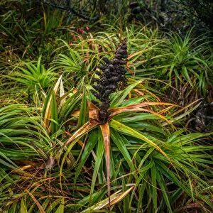
Richea Dracophylla in Southwest Tasmania
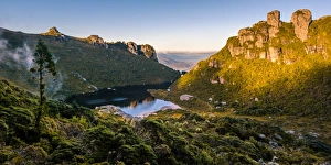
Lake Cygnus in Western Arthurs Range, Southwest Tasmania
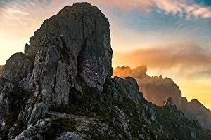
Sunset at West Portal and view towards Western Arthurs Range, Southwest Tasmania
Sunset at Arthur Plains in Southwest Tasmania
Dieback disease area at Arthur Plains in Southwest Tasmania
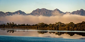
Lake Pedder and Western Arthurs Range, Tasmania
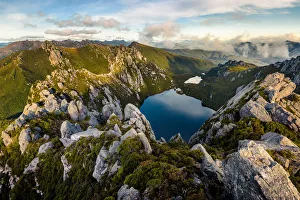
View of Lake Oberon from mt Oberonin Western Arthur Range, Southwest Tasmania
View of Lake Oberon Lake Uranus from mt Pegasus in Western Arthur Range, Southwest Tasmania
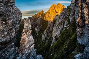
mt. Hayes in Western Arthur Range, Southwest Tasmania
Sunset over mt. Hesperus in Western Arthur Range, Southwest Tasmania
Lake Cygnus in Western Arthurs, Southwest Tasmania
Mt Hayes in Western Arthurs, Southwest Tasmania
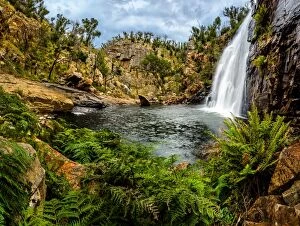
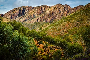
Mckenzie FallsBeen in dry and hot australian outback for while, it felt like a bless to hear some flowing water and feel mosture in the air the. Mckenzie Falls in Grampians of Victoria
Fringe Lily Creek from Razorback RidgeGoing down to Fringe Lily Creek from Razorback Ridge at West Macdonnell Ranges, Northern Territory
Angkale Junction at West Macdonnell Ranges, Northern Territory
Reveal Saddle at West Macdonnell Ranges, Northern Territory
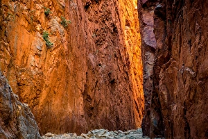
Standley Chasm at West Macdonnell Ranges, Northern Territory
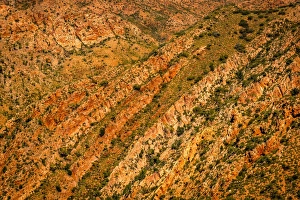
Chewings Range TexturesChewings Range textures at West Macdonnell Ranges, Northern Territory
Refuge Spring at West Macdonnell Ranges, Northern Territory
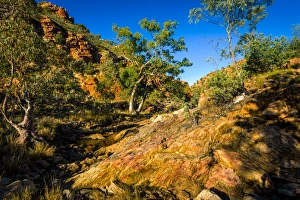
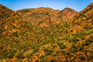
Chewings Range at West Macdonnell Ranges, Northern Territory
Hugh View at West Macdonnell Ranges, Northern Territory
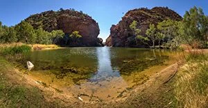
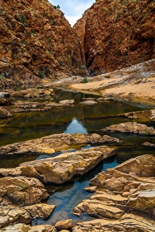
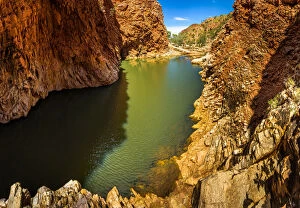
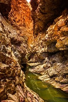
Ellery Creek Big Hole at West Macdonnell Ranges, Northern Territory
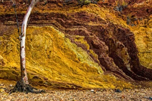
Orche Pits at West Macdonnell Ranges, Northern Territory
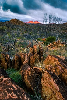
Razorback Ridge at West Macdonnell RangesView of Razorback Ridge from Linear Valley at West Macdonnell Ranges, Northern Territory
Redbank Gorge at West Macdonnell Ranges, Northern Territory
Sunset over mount Sonder. West Macdonnell Ranges, Northern Territory
Ormiston Gorge at West Macdonnell Ranges, Northern Territory