mail_outline sales@mediastorehouse.com
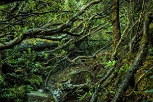
Track through at the rainforest at Ironbound Range, South Coast track, Southwest Tasmania
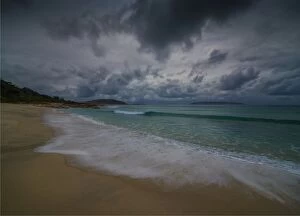
North east beachThe beautiful and empty beaches in the North east part of Flinders Island Tasmania are truly magnificent
The coastline at Sleepy bay, Freycinet Peninsular, East coast Tasmania
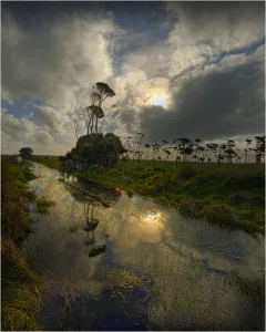
After a wet winter many parts of the rural landscape on King Island are soggy and lagoons and ponds fill with the rainwater. Bass Strait Tasmania
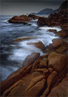
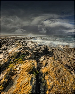
Bruny Island coastline, southern Tasmania, Australia
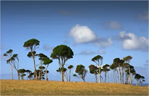
Melaleuca trees, so typical of the native foliage on King Island, Bass Strait, Tasmania, Australia
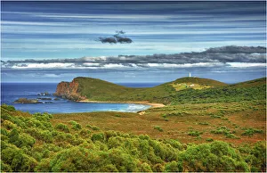
Stokes point, Southern end of King Island, Bass Strait, Tasmania, Australia
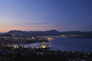
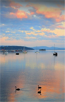
View of Hobart and River Derwent from Sandy BayThe city lights glow golden as the sun sets over Hobart
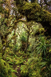
Rainforest at Goon Moor in Eastern Arthur Range, Southwest Tasmania
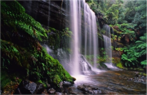
Russell falls in the Mount Field National Park, Southern Tasmania
The Enchanted walk leads to Pencil Pine falls in Cradle Mountain National Park, Central Tasmania
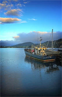
Dover, a small fishing village in the south of Tasmania
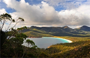
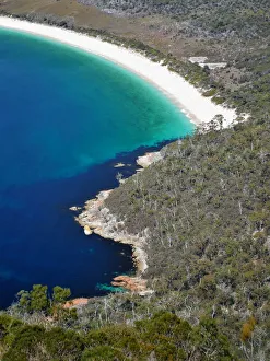
A view of Wine-Glass bay, east coastline of Tasmania, Australia
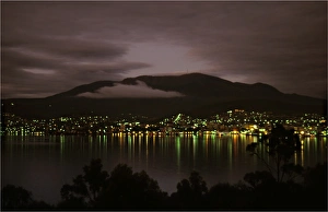
Hobart city at dawn as viewed from Rosny Point, southern Tasmania
Merry Christmas
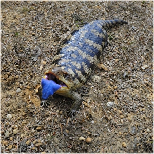
Blotched Blue tongue LizardA Tasmanian blotched blue tongue lizard (tiliqua nigrolutea) with its tongue fully extended in a display of hissing bluff
Map of Australasia (1898 engraving)Old map of Australasia from 1898
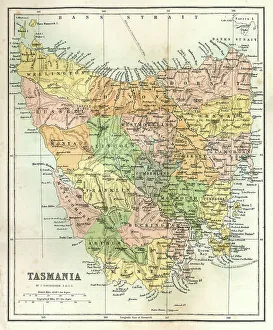
Antique Map of TasmaniaAntique map of Tasmania from 1867
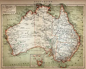
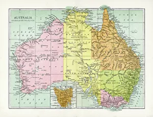
Antique Map of AustraliaVintage map of Australia, from 1894
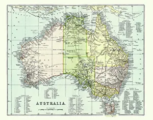
Antique Map of Australia Late 19th CenturyAntique Map of Australia in the late 19th Century
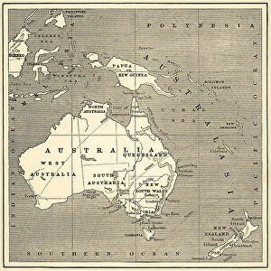
Map of Australasia (1882 engraving)Old map of Australasia from "Royal Geographical Readers no. 5" of Asia, Africa, America and Oceania, publ. T Nelson & Sons, London in 1883
JERUSALEM RIVER WATERFALLS, TASMANIAWALLS OF JERUSALEM NATIONAL PARK, TASMANIA, Ted Mead, 10183410
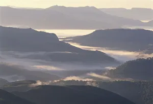
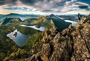
SOUTHWEST MOUNTAIN RANGE, SOUTHWEST NATIONAL PARKTASMANIA, Ted Mead, 10183404
View to Hawksnest Cove and Wineglass Bay, Freycinet National Park, TasmaniaColes Bay, Tasmania, Australia - October 2, 2017: The arc of Wineglass Bay from the Wineglass Bay overlook trail
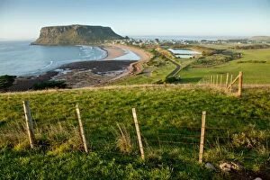
The Nut at Stanley. TasmaniaThe Nut at Stanley on the north coast of Tasmania. Australia
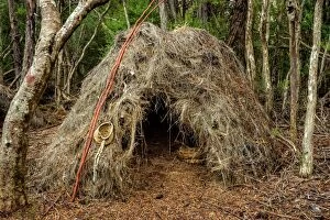
Aboriginal Shelter at Melaleuca, Southwest Tasmania
Following down the Lighting Ridge from mt Lot at mt. Anne circuit. Southwest TasmaniaFollowing down the Lighting Ridge from mt Lot, after cooperating on the on mt. Anne circuit. ašLake Judd on the right and Lonely ponds on the left. Southwest Tasmania
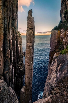
Totem Pole at Cape Hauy, Tasman Peninsula, Tasmania
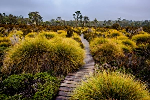
Boardwalk through button grass plains at Overland track, Tasmania
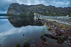
Lake Mackintosh and Dam in Tullah, Tasmania
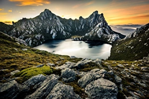
View of Lake Oberon from Pegasus South in Western Arthurs, Southwest Tasmania
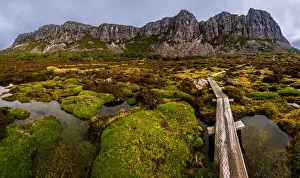
West Wall in Walls of Jerusalem National Park, Tasmania
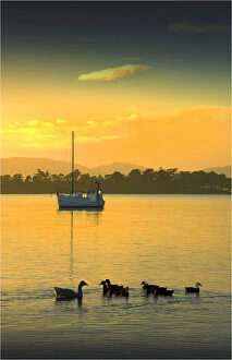
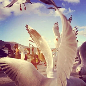
Seagulls and ducks fighting over breadSeagulls and ducks fighting over at river
Silhouette of two men jumping into the sunset skySilhouette of two men jumping high into the sky at sunset
Common brown butterfly floating on the surface of a swimming poolLooking down on a common brown butterfly floating on the surface of a swimming pool
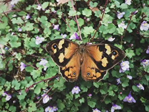
Common brown butterfly resting outside on some leavesLooking down on a common brown butterfly resting outside on some leaves
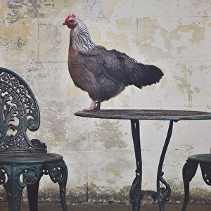
Chicken standing on top of outside table setting
Old rusty bike leaning up against wall outsideOld rusty bike leaning up against wall of building outside
Dromedary camel looking at the camera
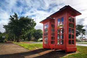
The Red Telephone Boxes in Ross, Tasmania, AustraliaThe red telephone box, a telephone kiosk for a public telephone designed by Sir Giles Gilbert Scott, was a familiar sight on the streets of the United Kingdom, Malta, Bermuda and Gibraltar
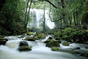
Sir Johns Falls, Gordon River, Tasmania, AustraliaSir John Falls is a waterfall on the Cataract Creek in west Tasmania, Australia situated about 140km west-northwest of Hobart. Sir John Falls is at an altitude of approximately 50m
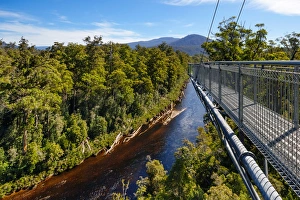
View of Huon River and the Cantilever Bridge on the Tahune Forest AirWalk, Huon Valley, Southern Tasmania, AustraliaThe Tahune AirWalk is a steel walkway footbridge located in the Tahune Forest area and sits over the banks of the Huon River
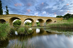
Richmond bridge tasmaniarichmond bridge at sunset in tasmania, near hobart
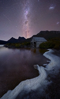
cradle mountain at night under the milkywaycradle mountain in Tasmania under the milkyway, down by the boats shed on dove lake